In nominal terms, electricity rates are up by an average of 33% over the past five years nationwide, adding $35 on average to household bills every month, or $420 per year. Prices in 32 states grew by more than 25% in that time, with six states experiencing increases of over 50%. As electricity prices increase, what was once a relatively stable line item in many Americans’ budgets is now more volatile, compounding broader cost of living pressures.
As the stakes rise for American consumers, the lack of transparency also makes effective policymaking more difficult: Regulators and politicians are making high-stakes decisions about reliability, affordability, and future investment with, at best, partial information.
That is why Heatmap and MIT are launching the Electricity Price Hub, a new public data platform built to address this information gap. The hub provides month-to-month estimates of residential electricity prices and bills for utilities across the United States, from 2020 to the present. For the largest utilities, these estimates are broken down into their core components. By making this data available down to the zip code level, the hub empowers users to understand what they are paying and see how that compares to neighboring communities and states.
That clarity is urgently needed. More than half of Americans say that power bills are causing at least “a decent amount” of stress on their budgets, according to a Heatmap Pro poll from last fall. Electricity prices have already emerged as a political issue in states like New Jersey, Virginia, and Georgia — and are likely to keep rising in voters’ minds.
Last year utilities asked state regulators to approve more than $28 billion in rate increases, according to the research and advocacy group PowerLines. Many of these rate increases won’t take effect for months or even years to come, meaning that some amount of price increase is baked in regardless of how the policy and technology environment changes.
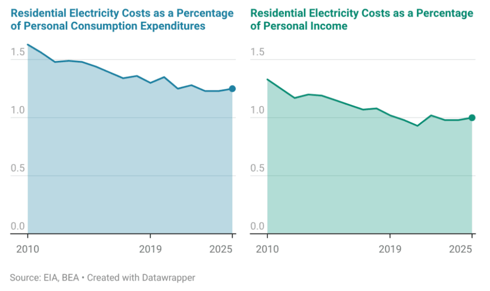
But electricity prices are not the only problem. If the cost per kilowatt-hour of electricity is analogous to the number projected on the neon sign at the gas station, the total monthly cost of electricity use is what you see at the bottom of your receipt when you fill up. As anyone who has ever driven a gas car knows, the ultimate expense is a function of both the size of your tank and how fuel-efficient your car is.
Even where electricity prices appear moderate, electricity bills can be high. Alabama Power, for example, has prices that are just $0.05 above (or 1.3x) the national average. But its average residential bills are among the nation’s highest, at nearly $100 over the national average. (Heatmap’s Emily Pontecorvo has more on how trends in prices and bills can diverge.)
In many areas, it’s not just that bills are rising. Sharp swings in bills are especially difficult for households to manage. The median difference between the highest and lowest bills in 2025 was $92 (a 91% difference). Zooming in on a subset of utilities with the greatest bill volatility, peak-to-trough bill differences often exceed $200, with percentage swings of 200% to 280%. Two utilities in New Jersey, for example, saw average residential bills increase by more than $275 between spring and peak summer months.
Why have electricity prices remained so deeply opaque? In part, this is a function of the byzantine structures that govern our electricity system. We have three major grids, seven regional transmission authorities, 51 state-level regulators, more than 800 rural co-operatives, and roughly 3,000 utilities.
The result is a data environment that is fragmented and inconsistent, and lags well behind real-time price changes:
- Because the U.S. power sector is fractured, information is scattered across a variety of sources. Different aspects of the system are governed and reported by federal authorities, state regulators, regional transmission organizations, independent system operators (ISOs), and individual utilities.
- In addition, one data source is not always comparable to another. Each state and utility makes different types of data available, and some are more transparent than others.
- Existing national datasets are also often too slow and lack the level of granularity users need to understand and parse trends in retail prices. The best-in-class federal data sources on the topic, for instance, tend to trail real-time price changes by three to 21 months. The metrics reported allow users to estimate a utility’s average price but don’t allow for detailed examination of specific rate plans or of the different elements that add up to a customer’s total bill.
In the absence of reliable data, simplified narratives fill the void, allowing anyone to pick their chosen villain — be it renewables, data centers, transmission lines, or environmental policies — to blame for system failures. Policymakers risk adopting blunt measures that provide limited and temporary relief but that fail to address critical underlying issues, including the investments required to protect the grid’s long-term reliability and affordability.
Addressing these challenges starts with more timely and detailed data. That is what the Electricity Price Hub is all about. The platform delivers timely data for utilities serving the vast majority of residential customers in each state, with standard estimates that are comparable across states with different regulatory systems and across utilities with different rate structures.
It provides monthly, up-to-date estimates of both electricity prices and bills for a typical residential customer, offering a clearer view of the real cost burden households face and how that burden varies across places and over time. These estimates are more current than any existing public data sources.
We construct these estimates by combining detailed price and price component data for the largest utilities, sourced from state filings and utility rate books. We complement that with data for a wider set of utilities from the U.S. Energy Information Administration to generate standardized, current estimates of monthly average prices and bills.
We also disaggregate electricity prices into their core components: generation, the cost of producing electricity; transmission, the cost of moving power over long distances; distribution, the cost of getting electricity “the last mile” to homes and businesses; and other, a grab bag of regulatory and system-level charges. (You can find more on our methodology here.)
By standardizing and updating this information on a monthly basis, the platform is designed to inform consumers and businesses, and equip federal and state policymakers, regulators, and researchers with the information needed to design targeted, evidence-based responses.
You can now explore this tool for yourself, but here’s what we’ve already learned: There isn’t one cause of rising electricity costs. Prices are rising for different reasons in different places. There is no single national explanation for surging power prices.
Take our data on Maine. The state has long had some of the country’s most expensive electricity prices, and in recent years, distribution-related charges have been rising steadily. The utility Versant Power, for example, has seen distribution charges more than double over the last five years. The rising costs of maintaining and repairing aging distribution infrastructure, made worse by the increasing equipment and construction costs, are behind that trend.
In other parts of the country, extreme weather is driving higher distribution costs. While wildfire-related costs in California currently offer the most extreme example, storm costs are showing up in rising bills across the country. In Florida, for example, Tampa Electric customers have seen storm-related charges rise steadily, increasing from a credit in 2020 to more than $0.027 per kilowatt-hour in 2025.
Elsewhere, other factors are at play. In parts of the Mid-Atlantic, persistent bottlenecks in adding new capacity to the grid — as well as surging power demand, driven primarily by data centers — are causing generation costs to get bid up. In New Jersey, for example, the utility Atlantic City Electric Co’s generation-related charges have increased by more than 50% year on year.
You can already find other stories from the Electricity Price Hub from Heatmap reporters across the site. In some states, for instance, “other” charges are driving up power bills. We also look in detail at what’s going on with prices in PJM Interconnection, the country’s largest grid.
We hope this hub is only the beginning of a new era in open electricity data. If we want a modern electricity system that can deliver affordability, reliability, decarbonization, and economic growth, we will need a modern, up-to-date, and localized data infrastructure to match.


 LBL
LBL

