You can also add the show’s RSS feed to your podcast app to follow us directly.
Robinson Meyer:
Hello, it’s Wednesday, October 21, and the midterm elections are in two weeks here in the United States. Of course, every midterms, the focus is on Congress. And so you have heard a lot — and you are going to hear a lot — about the House races that matter and the Senate races that matter and what all of it could mean for the next presidential election.
But the thing is, during the midterms, there are a lot of important state races, too. And while they may not matter as directly to national politics, or may not seem at least to be as important as national politics, they do matter and are very important to our national emissions — and, by the way, to the country’s energy policy. In fact, a lot of the most important decisions about, say, your local electricity mix, or how you get your energy, or how the local utility are run, all happen at the state level, either in the state house itself, or at the Public Service Commission, which regulates utilities, and other monopolies.
So today, just as we did in the run-up to the 2024 election, we are talking to someone who specializes in looking at those state-level climate races that matter. Caroline Spears is the founder and executive director of Climate Cabinet. It’s an organization that selects and highlights the most important state-level races for climate policy. We talk about what's at stake this election, what state races might matter the most, and what races to watch on the night of to see how things are going. It's a fun, quick episode. I'm Robinson Meyer, the founding executive editor of Heatmap News, and it's all coming up on Shift Key.
Caroline Spears, welcome to Shift Key.
Caroline Spears:
Thanks for having me.
Robinson Meyer:
Thanks so much for coming back. I feel like this is becoming a regular segment. It's funny, the midterms were approaching, and I was like, “We have to get Climate Cabinet back in.”
Caroline Spears:
Listen, see you every two years, Rob. Lovely to be here.
Robinson Meyer:
Exactly. As I just mentioned, we had you on and talked about Climate Cabinet right before the 2024 election of blessed memory. Can you just give us a reminder of what Climate Cabinet is, for people who haven't heard about it before, what you guys do and what makes you different?
Caroline Spears:
Yes. OK, so at Climate Cabinet, what we do is, we support state and local officials across the country who are great on clean energy and they're great on climate. And we help them win their election. After the election, we also have people in the state capital with them every day as they take votes on some of the biggest climate issues in the country. So that's what we do at Climate Cabinet. If you're familiar with the movie Moneyball, it's a little bit like that. These are under-the-radar people running for these really important offices across the country who get overlooked because they're not in Washington, D.C., and they're not running for the U.S. Senate, but they're still really important. And together, they make up the team that will kind of right the ship on clean energy and climate policy in the U.S.
Robinson Meyer:
When you Google “Climate Cabinet,” the first description is Moneyball meets climate elections or Moneyball meets climate politics. And I was going to ask, I mean, one of the ideas of Moneyball is, as you just said, that there are these diamonds in the rough, right? That there are these underappreciated, undervalued races or, I mean, in the case of baseball, players out there who aren't appreciated. Has that gotten harder or easier since you started Climate Cabinet at this point six years ago?
Caroline Spears:
Yeah, six years ago. What I think has been really exciting over the last six years is we've seen more and more attention on this level of the ballot. So when I talk about something like a state energy chair or a public service commission race or land commission race, I'm actually starting to see the types of offices that we've focused on in the past get more and more attention over the last few years. That's such a positive. And I hope that trend keeps going.
Robinson Meyer:
We are two weeks out from this election. I want to get into specific races in a second, but how are you thinking about a climate cabinet?
Caroline Spears:
A midterm election, first and foremost, is usually voters show up to the polls. It's a report card on how the current president is doing. So that's the first thing I'm looking for. The second thing I'm really looking at across the country this year is what issues are bubbling up for people. And, Rob, it's not every year that energy is the top issue, but I was knocking doors in Bucks County last week. People were bringing up utility bills on the doors.
So that's the other thing I'm looking at, is what issues are really bubbling up for people. And how do those issues tie to their view of the presidency? What we have at stake is obviously the U.S. Senate and the U.S. House. It's control of the federal government. Over 30 governors are also up. So almost every governor in the country. And then we have control of every state House. So it goes all the way down the ballot. And that's what those two national themes are going to feed into. Who holds power on election night?
Robinson Meyer:
I think that right now, obviously, these elections do not seem like they're going to go well for the president, for the Republican Party. There's some question of, you know, are Democrats going to perform as well as the polls say they're going to perform? Are they going to outperform the polls? There's like changes in the electorate, even over the past 10 or eight years, that have made us think now Democrats might overperform because they're the more highly educated party, specifically during midterms. But what to you is like still uncertain about this this election?
Caroline Spears:
One thing we've been tracking since the ‘24 election is how both parties are doing in the special elections and then how both parties are doing in last year's elections. And so far, generally, what we're seeing is a national environment that looks much like 2018, but a little bit more favorable to Dems. So that's kind of what we're seeing from the specials, from the 2025 races.
The big uncertainty and my big unknown going into this election is what is going to happen with Trump's base specifically. There's a lot of anger right now about rising prices. You know, he ran on this message to lower costs, and costs have done anything except go down. We saw a lot of that in the specials, but specials are so different. It's a really different group of people that show up. That's my big uncertainty going into the midterms is what's going to happen with the base. And I've seen polling that's all over the place about that. And I kind of don't know how to make heads or tails of it.
Robinson Meyer:
It almost sounds like then the question is, do these people who've been voting for Trump in the presidential elections at this point for three times in a row, like, do they show up and kind of provide some deep shielding for Republican candidates? Or do they show up and they're so angry at Trump that they decide to vote for the non-incumbent party because they're pissed at the Iran war, they're pissed at prices, they feel like they voted for Trump to get certain policies and they're not getting them.
Caroline Spears:
I think the first piece to just know going into the midterms is Trump's base shows up less during the midterms. That's just baked in from the start. What I'm interested to look at on election night is, do people just not show up at all? That's really where I think this is going to go. I don't think we're going to see a lot of people who switch parties. Not so many. But do people just stay home and not show up? I think we're going to see some of that this midterm election. The scale of that. That's my big uncertainty is, I know we're going to see a little bit less. But I just don't know by how much. And a lot of these races that we work on and that I think about all the time are decided by like 3 percentage points. So just a small number of people not showing up means a big change.
Robinson Meyer:
What are some of the big states or state-level races that you are thinking about right now?
Caroline Spears:
The two buckets that I'm really thinking about for this midterms election are state control, who controls state governments by the end of election night. And I'm also thinking about a basket of races that I call weird state whites. Those are public service commissions. I think about state Supreme Courts. I think about land commissioners. So those are the two buckets that I'm thinking about. When it comes to states, just to level set in what state control means, you got the governor and you got the House and the Senate. Very standard. So it's just like the federal. When you look at how many seats that is, 7,383 state-led seats in America. So there's just thousands of them that control how states pass policy and how they don't pass policy. Out of those 7,000 seats, 22 are the difference between five new Dem trifectas.
Robinson Meyer:
Wow.
Caroline Spears:
Big map, but just a handful of seats are going to control the outcome in November.
Robinson Meyer:
And why is that? Is that because each state has gerrymandered its own state level district so much that you wind up with? I mean, this happens in the House of Representatives at the national level, too. You wind up with these like the all of House control winds up coming down to like the same 25 or 30 races over and over. But is that because basically there's a version of that in every state? Or is it just because the geography is already sort of polarized to the number of places even on a non-gerrymandered map that are competitive is truly small?
Caroline Spears:
It's a combination of things, but I would say redistricting, especially in the decade of the 2010s, has just gotten more and more extreme. It started in the 2000s. It's really gotten more and more extreme. We have a federal government has not stepped in at all on the gerrymandering. And these state legislatures, who controls the state, they also redraw on the map for the House of Representatives. So they're enormously powerful and they've used that power to sort of insulate their current majority from the voters, essentially. That's what gerrymandering and redistricting are doing in these states. So that's why you've got a very narrow map, like you said, very similar dynamic to the House of Representatives.
Robinson Meyer:
At the national level in the U.S., right, we have the House of Representatives, which is reelected every two years and through districts that are redrawn every 10 years until recently. We can get into that. But districts that are redrawn on a regular basis. Then we have the Senate.
Caroline Spears:
They're supposed to be drawn every 10 years. You're right. Legally, they should only be drawn every 10 years. Is that happening now? Not at all.
Robinson Meyer:
No, no, there's a whole disaster.
Caroline Spears:
Exactly.
Robinson Meyer:
But aside from that, then we have the Senate, which is every six years along state lines. And those districts don't change, obviously, because senators are elected on statewide boundaries. One funny thing about states as they run today is that the Supreme Court has spent the middle of the 20th century basically getting rid of the state-level senators. So for instance, there's one person, one vote guaranteed at the state-level government now across different districts. You can't have some people mapped into different districts. Are there still like state assemblies with different terms? Like, does a state legislature and a state assembly have two different term lengths?
Caroline Spears:
Oh, yeah, we've got different term lengths. Rob, it's like every I can find you an edge case. We have a great data science team at Climate Cabinet. And the number of edge cases they have to deal with when they talk about state legislatures is out of control. West Virginia has per-district different numbers of state house members per house district. So in some districts it'll be two. Some districts there'll be five. I mean, every state truly writes their own rules. And that's how you end up with a thing like the Texas Senate has about 30 people and the Vermont House has over 400 people. And that's how you end up with a situation.
Robinson Meyer:
Yeah. Let's talk about those states then. So you're tracking five states that could switch into being Democrat trifectas. What are those states and what would it mean for their climate-level policy and governance?
Caroline Spears:
So I'm really looking at five seats that have a couple hundred state legislature seats, but if 22 of them flip, we have a much bigger opportunity to pass clean energy and climate legislation in 27. So I'm thinking about Minnesota and Michigan, Wisconsin, Pennsylvania, Arizona. Those are kind of the five when you're thinking about big changes in state-level control from a trifecta perspective. Together, those states would be roughly the world's ninth-largest climate polluter if they were their own country. So big climate impact.
Robinson Meyer:
What kind of policies are on the table if they have a democratic trifecta in those states? Obviously, the states go into this with different state-level policies already. And so it's hard to maybe talk about different policies that are on the table. But like, what are candidates or legislatures talking about?
Caroline Spears:
From first principles, you can look at what's happening in those states already. So take a state like Arizona. I've said this in the past: Arizona is getting better. It still has fewer solar jobs than many other states, like Massachusetts, for example. And it's really hot. Arizona should be doing way better. Arizona should be an energy exporter. They should be kind of a breadbasket of solar energy. So that's the potential on the table. And instead, they've had a series of governments that have sort of blocked progress on clean energy in the state. That's a great example of kind of what happens when you don't have people who are thinking about the clean energy economy and actually actively trying to block it at the state. So that's kind of the two paths diverging in a yellow wood. You can also look at, in 2022, Minnesota and Michigan flipped to a trifecta. They both passed 100% clean energy. Whereas Arizona, Pennsylvania, and Wisconsin didn't, they don't have that law in the books. So that's kind of the two options.
Robinson Meyer:
So it also, I would imagine, is hard to talk about exactly what these legislatures are going to do because we don't. They haven't been elected yet. And we don't know exactly how far their governor would push or how far their legislative teams would push until they win, just like we don't know what this incoming Congress will do.
Caroline Spears:
We have some idea, though. Like Governor Shapiro has the lightning plan that would, you know, Pennsylvania currently only gets 3% of its energy from renewable energy. It would increase renewable energy in the state, solar, batteries, etc. He can't get that thing through the legislature right now. He's struggling to pass parts of it he can do, but he's really struggling to pass that whole bill. So we do have some indication of some of these states already have incumbent governors. They're trying to do stuff. They're getting stopped by their legislature. So we know flipping the legislature is the path forward.
Robinson Meyer:
So let's talk about the state-level weird elections. These are things like public utility commissions, I would imagine. What are the big, weird state races that you're tracking? Maybe the names at the bottom of the ballot that people wouldn't otherwise be paying attention to.
Caroline Spears:
Yes. And I'm sure everybody else has had this thought where you get to the bottom of the ballot and you're asked to vote for justice of the peace. That's where I really start struggling.
Robinson Meyer:
When I was a first-time voter, I was voting in Illinois elections. And at the end of every Illinois ballot, you're just asked to, like, vote on, you know, pick several dozen judges. Here's a long list. Pick the good judges. How do you make sure that voters don't just stop voting when they get down to these names at the bottom of the ballot who they don't recognize for positions they may not know?
Caroline Spears:
So there's this term in elections that we call down-ballot drop-off, which is people filling out the top of the ballot for, for example, top of the ballot for, for example, president or Senate and just not filling out the rest of the ballot. One of the things that we're trying this year, this has been a big problem at the Public Service Commission. We are losing winnable Public Service Commission races because of down-ballot drop-off and solely because of down-ballot drop-off. Unfortunately, or fortunately, depending on how you look at it, some of those offices are really important for clean energy. So I think of something like a land commissioner office, an elected office in the state of New Mexico, Juan Sanchez is running for the land commissioner race there. He was our first endorsed candidate of this cycle. And the land commissioner oversees millions of acres of New Mexico public land. And it's the steward of those public lands for this generation of New Mexicans, but also generations to come. So that's siting and permitting. That's natural land access. There's a wide variety of things that the land commissioner covers critical for climate. So that's one of these weird statewides that I'm looking at.
Robinson Meyer:
What about some of these public utility races? The Public Utility Commission, as we've discussed in the show, not often elected, not elected in many states. Yes. But in a few states, voters do go pick their public utility commission. These are the people who govern and oversee, at least in theory, the local utility. What PUCs are up this year and what are they talking about doing?
Caroline Spears:
The first three public service commissions I'm looking at that are elected this year and really top of mind are Arizona, Georgia, and Louisiana. Those are the big three for the year. I think Arizona is very interesting this year because we already had a utility election in Arizona earlier this year. Turning Point USA got very involved at the Salt River Project, which is a smaller kind of utility board within Arizona in the Phoenix area. For the first time, clean energy candidates flipped the board of the Salt River Project. Now it's like, if that was a small utility election in Arizona, now we have the big one. So that was just a trial run. Turning Point USA was very upfront. That was their trial run as well. They lost those races. They're trying it again. They actually primaried a Republican incumbent. So they have one of their candidates running for the Arizona Corporation Commission. And there's two seats up in Arizona. They've been very challenging from a few perspectives. One of them is that the current kind of 0-5 anti-climate majority on the commission has sort of thrown everything at the solar industry in particular. They've lowered the renewable portfolio standard almost out of spite because Arizona had already passed it. It's like a statute from a while ago. They've raised rates on rooftop solar. They've raised people's electricity bills something like four times in two years. So it'll be an interesting one.
Robinson Meyer:
You said it was 5-0 against clean energy. Are these partisan candidates in the Arizona PUC? And so is it 5-0 Republican controlled? Or is it just there are anti-clean energy Democrats on there?
Caroline Spears:
Currently, it is 0-5. All five seats are held by Republicans. There's also a fight going on within the Republican Party over the Arizona Corporation Commission, where you have kind of Freedom Caucus people trying to primary Tea Party people. So there's a Tea Party Freedom Caucus knockout, dragout in the ACC. We saw that in the primary where one of the, I'm going to call them a Tea Party Republican, was knocked out by the Turning Point USA Freedom Caucus member. So I think it's not enough to say it's Republican-Democrat. You have to go one level deeper to know that there's also this civil war going on within the Arizona Republican Party right now over the future of the party.
And we see that at the ACC as well. I mean, what's been wild about Arizona, and this is a down-ballot drop-off, why it's so critical, is in the last decade, if you look at how Arizona elections have gone, Democrats have picked up the governor's mansion, they've picked up the attorney general, they've picked up one Senate seat and then the next Senate seat. In those same elections, they have lost multiple seats on the Corporation Commission, at the PUC. And it's because of down-ballot drop-off. It's because there's a group of voters, and you can find where folks are by precinct, and you can kind of put all those precincts in a table. There's a group of voters who just aren't filling out that section of the ballot.
So one thing we're trying this year, this is an experiment. I'll let you know how it goes after the election, is we took the top 20 or so precincts where the down-bought drop-off is the worst. And in 10 of those precincts, we're going to try to do a few things to help down-bought drop-off get better. And in 10, we're not going to do anything. And we're going to A-B test it and see how it goes. This is the type of thing we have to start figuring out. It's getting much better on in order to start winning these public service commission races systematically over time.
Robinson Meyer:
In the Arizona PUC, to the degree you can talk about it, especially on the Republican side, is this an election that is primarily being fought over bills and all three types of candidate here? Let's say like the Tea Party Republican, the Freedom Caucus Republican or the TPUSA Republican and the Democrat are all saying, we're going to make your bills go down. Or is this election fought closer to like what we see in presidential elections where the Republicans are actively like, we think fossil fuels should be a bigger part of the power grid in Arizona and we're going to do what we can to like boost fossil fuels.
Caroline Spears:
There's been a little bit of both, I think, from a primary messaging standpoint on the campaign. Like, you can dig into every candidate's long history of talking points, and you can hear candidates getting excited about bringing coal back, that type of thing. You know, I was in Phoenix the week before the Salt River Project vote. And what really stuck out from that is everyone's talking points are almost the exact same. They're all lowering bills. They're all anti-data center. So from a campaign messaging standpoint, there's not a bunch of differences. Again so confusing for voters because you have some people who are running who've been an incumbent for years and have raised rates on people. And all of their campaign signage, very similar to everybody else.
Robinson Meyer:
The Salt River Project was a fossil power plant? What was it?
Caroline Spears:
So the Salt River Project, we're about to get into a little bit of wonkiness on the Arizona utility side.
Robinson Meyer:
That's okay. That's okay. That's what we're here for.
Caroline Spears:
That's what we're here for. So the Salt River Project, it's kind of like a mini elected public service commission. It's a water board and an electric board. It's one of those kind of holdovers that was set up about 100 years ago, and we still have it.
Robinson Meyer:
It's like a public authority, basically?
Caroline Spears:
Yes.
Robinson Meyer:
So it's kind of like a pre-New Deal government within the government.
Caroline Spears:
Don't quote me on exactly when it was set up, but it was set up so long ago, Rob, that to cast a vote for the Salt River Project, the number of votes you get is the number of acres you own.
Robinson Meyer:
Oh, my gosh. Okay.
Caroline Spears:
Yeah. Great. So, right. Not our most democratic institution in the U.S.. And there's been interesting legislation to make it a democratic institution and say one person, one voice, not one acre, one voice.
Robinson Meyer:
Yes.
Caroline Spears:
That has all gotten stalled out in this current legislature. So you have a little bit of these different levels of government fighting with each other over who gets to control what.
Robinson Meyer:
The Salt River Project has like authority over a particular set of state jurisdictions, like power plants and water and but like not all of them, just some of them.
Caroline Spears:
Just some of them. Yes. Yes. Power plants and water. So the benefit of flipping the Salt River project is that you can push for more clean energy projects to be built. You can think of the Arizona Corporation Commission, the statewide PUC, as like a bigger version.
Robinson Meyer:
What's happening in Georgia? Because I remember last year was a big deal. Democrats won the state level Georgia races in the PUC is a big deal because it kind of wrapped up a lot of issues we had started talking about then into one story. It was a rebellion against Southern Company or Monopoly Utilities or Georgia Power. Really, it was a rebellion against what were beginning to be understood by voters as maybe data center costs. Where does this race stand? Because last year, those races got a ton of attention. How does what's happening this year connect to what happened last year?
Caroline Spears:
Last year was really the canary in the coal mine. We saw a few candidates who ran on electricity bills and really overperformed their fundamentals. It was true in Georgia with those public service commission races. It was also true in some state races we were involved in last year as well. We saw that kind of across the country where we had a few candidates.
Robinson Meyer:
It's kind of a New Jersey story too.
Caroline Spears:
Yeah, it was in New Jersey. There was a candidate, John McAuliffe, who flipped Loudoun County, a Loudoun County district. He overperformed by about 10 points. And if you can pick one county in America that says data centers. It's Loudoun County.
Robinson Meyer:
Yes, that and horses. Yes.
Caroline Spears:
Yeah, beautiful place. So what we saw at the Georgia Public Service Commission was absolutely an indictment on energy bills, energy costs. Now, last year, the Georgia Public Service Commission candidates who won, the Democratic candidates, won by 60-40, which was astonishing in the state. I don't expect those margins again. I think it's going to be much tighter this year.
Robinson Meyer:
If they win on this PUC, it would give Democrats majority on the Georgia PUC. Is that right?
Caroline Spears:
That's right. It's a majority-making race. In Arizona, there are only two seats up. It's a seat of five. We're not looking at a majority this year in AZ. That's not on the table. Georgia majority is on the table this year. It's very contested. That's a big fight this year.
Robinson Meyer:
nd you mentioned Louisiana at the last big fight. Just what is the terrain in Louisiana? Because I think if there's any state where it would seem like Democrats would have the hardest time winning, it would be a Louisiana state-level election.
Caroline Spears:
I'm really interested in what happens in Louisiana. You've sort of had this a little bit of people crossing party lines to building kind of the first pieces of consumer protections. I'm interested to see how candidates perform independent of their party. I am watching those. And there's this kind of knockout drag out with the legislature and the governor there, too. And we've seen this, Rob, in race after race. If one of these weird offices gets a little too ahead of the governor or the legislature, they will come in and try to strip authority away. Louisiana is the story of a power struggle. People are trying to call a constitutional convention to limit the power of the public service commissioners. There's a big political split between the POC and the legislature. And we've seen that in Arizona, too. That's a classic where your trifecta, your governor, your House and your Senate, if other offices throughout the state, get a little too opposed from where the trifecta is, the trifecta will come in and try to strip authority away. So that's something I always watch when I'm thinking of a race that's not a governor, a House or a Senate is what is the probability that the legislature will come in and try to take authority back?
Robinson Meyer:
I mean, we were talking about it a little bit in the context of Arizona, but what are the stakes in any of these PUC elections for climate change?
Caroline Spears:
They regulate the entire electricity market in their state. So when you're thinking about what do we want to build, how fast do we want to build it? What types of energy does a utility build? How fast? They have a lot of authority over speed and permitting. And they have a lot of authority, which usually they don't use, on saying, hey, monopoly utility, you have to let independent power producers in. Normally these public service commissions, whether they're elected or appointed, are captured by the utilities that they regulate utility capture of public service commissions is kind of pervasive and bad, because it leads to higher costs for people, and so we've seen that story play out over and over again maybe the whole electricity market. Let's actually to just go one level more it's important for what types of electricity that we're going to build. And do we build clean or do we build fossil?
Robinson Meyer:
I mean, does it even change what the utilities ask to build? Because if they know they're going to have a friendlier majority for renewables or a friendlier majority for gas, like does it affect what they even proposed to the PUC in the first place?
Caroline Spears:
Absolutely. You see, for example, in Arizona and Arizona Public Service, when they think they're going to get a little pushback from other areas of the government, they'll come out with voluntary clean energy standards. They're like, don't codify it. We have voluntary clean energy standards. And then when people who are opposed to clean energy take power, all of a sudden those voluntary standards just evaporate into thin air.
Robinson Meyer:
They go away.
Caroline Spears:
Who could say where they went? And I would say cost too. You know, you have some of these public service commissions approving things like quick financing. There's all these financing hacks the utilities can use to make people pay more than they should for the electricity that they have.
Robinson Meyer:
How can these elections go wrong? Because we were talking before the show, like Arizona, I think, used to have a very pro-clean energy PUC. Obviously, now it doesn't. It's 0-5, as you were saying, against clean energy or Republican-controlled. Is there a risk that playing up the climate bona fides of these races kind of deters voters from choosing those candidates because voters actually just care about costs and reigning in their local monopoly? They might care about climate change, but if a candidate talks about climate change, it might be more of a signal that the candidate is willing to put other things before cost.
Caroline Spears:
I mean, I can tell you what our most successful candidates did last year and this year is, they're talking about cost.
Robinson Meyer:
Yeah.
Caroline Spears:
That's who's successful. So when we think about those Georgia Public Service Commission elections last year, Peter Hubbard and Alicia Johnson ran a bills-first campaign. How can we lower your household bills? And so that's who's being successful in these races. And it's because our best candidates are the people who talk to voters a lot, door-knock a lot. They're hearing what people want to talk about. And they're saying, “Hey, how can I use this office to actually be helpful there?” So, yeah, I mean — that's a good campaign, which is: What do people care about? How am I going to deliver for that?
Robinson Meyer:
Yeah. There's only been that small set of elections since affordability really became a national issue and an issue that I think Democrats felt comfortable leading after the 2024 election. We've only had the ‘25 elections. And I guess in ‘25, you could say Mikey Sherrill in New Jersey. I realize I keep bringing up New Jersey, but it's New Jersey and Virginia that are the only two off-year cycles. And I guess actually in both of those states, we've seen the Democrats who then won in the ‘25 election put affordability right at the center of their governance. But there's not a lot of other track record to point to.
Caroline Spears:
Yes. What I will add to that, though, is usually when you're going into an election year, again, a good successful candidate is talking to voters a lot. You will see legislative action that kind of presages what you think is going to happen in ‘27. We've seen so many data center bills, Rob. We're all drowning in data center bills. Over 300 were introduced in the first six weeks of 2026. It's been wild. The big thing that a lot of states have gotten passed, not that many, but just like the modal data center bill has been rolling back the tax breaks the data centers have received, which is a good start, but doesn't even get close to where voters want politicians to be on data centers. So we're going to see a lot more of that. If this year was crazy, next year will be even more so.
Robinson Meyer:
I mean, we're looking forward to covering all of that at Heatmap, obviously. How do you talk to voters or even donors about this climate-hushing trend? I started to see Democrats talk about climate hushing or started to see discussion of Democrats talking less about climate. We've been tracking this at Heatmap. I think one interesting dynamic is this is not a moderate issue. This is not a progressive issue. We really see both sides of the party doing it, both sides of the party emphasizing affordability or promising they're not going to, as Abdul El-Sayed did, defend or fight for a Green New Deal. How do you interpret that trend within the context of wanting to elect more climate champions to state or local office?
Caroline Spears:
Something that's been true for all of the years in which we've supported climate champions and clean energy champions running for public office is that the best candidates are the ones who... Talk to the most voters and are good at talking to voters and saying, “Hey, what do you want?” How can I be helpful? So let's talk about 2022, a year where climate was really in the zeitgeist. And are we going to get the Inflation Reduction Act? One of my favorite candidates that year was running for a city council ward four. So city council race.
Robinson Meyer:
What city council?
Caroline Spears:
Columbia, Missouri, and he was running for that race and I went to go knock doors, it was like what do you want to talk to voters about what's been really interesting and he was like listen, I ran the largest volunteer services center like anytime anyone did any volunteer activity to help people in the community. I ran that for over a decade, and that's what everybody knows and just mention that on the doors. And you know what? That guy won handily his race. And that was the year in which you'd think climate, you know, it's top of mind. Everyone's talking about it. So it's just always been true that our most successful candidates are the ones who knock a bunch of doors and talk to a bunch of voters and are good at talking about that. That's where I struggle with the whole climate hushing conversation is I'm like, listen, it feels a little bit more theoretical. And like this conversation that's happening online. And not at the doors when you talk to voters. So when I show up, I mentioned I was in Bucks County recently, and I was talking to voters and everyone was talking about cost of living. People independently brought up: “My utility bills are too high, and I think it's from the data center down the road, and I don't like either of those two things, and I want people who have solutions to that.” Four years ago, that same voter, what were they talking about? Probably it wouldn't have been super far off the mark from that. And that's where I struggle with the climate hushing kind of dialogue a little bit because I'm like, I don't know. The best people running for office are always good at listening to voters.
Robinson Meyer:
And relating what they want to do to what voters want to have happen.
Caroline Spears:
Yeah. And as a clean energy industry, does clean energy have solutions to data center costs? Absolutely. Cheapest to grid. There are lots of ways people can put DERs to kind of insulate themselves from rising home prices? How can we make that more accessible? How can we do siting and permitting on clean energy such that people can get power directly into the grid faster and lower people's bills in sort of a rising electricity load environment? So that's what I think about climate hushing, which is I don't think about it at all. I think about what voters want and how we deliver that for them.
Robinson Meyer:
So we're recording this. By the time this episode comes out, we will be less than two weeks out from the election. Now let's cast our mind forward. It's the evening of November 3. What are you looking for on November 3? What are your benchmarks for things going really well for Democrats on Tuesday night or climate champions and things going poorly?
Caroline Spears:
So on election night, I'm looking at a few states. I'm looking at a few candidates in a few states. If I can give you kind of three places that I'm looking at candidates, I'm looking at Bucks County, Pennsylvania. I'm looking at Wisconsin Senate District 21. I'm looking at — this is going to get real wonky real fast — I'm looking at Eileen Albiar's race in the Pennsylvania Senate. I'm looking at Trevor Jung's race in the Wisconsin Senate. I'm looking at Aaron Lieberman's race in the Arizona Senate. And those are my three bellwether candidates to say, hey, how's this night going for our ability to pass clean energy or climate legislation in ‘27?
Robinson Meyer:
And you expect data to come in there faster, or those are just like going to be the bellwethers for each of those states?
Caroline Spears:
No, those will be the bellwethers for each of those states. We don't get a lot of results super fast. People tend to really tally those Senate races, and we have to wait a little bit, which is unfortunate. But those are the bellwethers to figure out whether we have a 2022 kind of era of climate policy, which is a good era for climate policy. We passed a bunch of ones, a bunch of state policy in ‘23 and ‘24.
And then I'm looking at map expansion. So those are the places I'm looking. Bucks County gets consistently talked about. If y'all follow politics, Bucks County is covered a ton. So I'm really looking at the returns there. But thematically, I'm looking for those candidates, and I'm looking for ticket splitting. I'm looking at how much are voters voting for that top section of the ballot and leaving the whole rest of their ballot undone or splitting their vote between parties, within parties. Yeah, ticket splitting is the big one. We're running a bunch of experiments this year on that, which I'm really excited about. What are all of the ways in which we can encourage people to keep filling out their ballot or not skip over the Arizona Corporation Commission? So we're running some experiments on that. And I'm really going to look at ticket splitting on election night.
Robinson Meyer:
We are a nonpartisan podcast, obviously, but let's say there's listeners out there who are like, is it too late to donate to some of these races? This episode will come out on October 21. We'll, of course, stick Climate Cabinet’s link in the show notes. But just like, is it too late to donate to some of these races or can money still be useful to some of these candidates?
Caroline Spears:
It is late, but it's not too late. What we are doing in the last kind of couple weeks of the election is if you go to our website, there's a final few people who we think could really make it over the finish line, but are getting outspent. A lot of our candidates this year are getting outspent about 2 to 1. Yeah. I have a lot of candidates, Rob, who are tied in the polls and getting outspent 2 to 1. I don't love being there right now. That's where we are with a lot of our candidates. That's the difference between a trifecta and not a trifecta. That's kind of what we're looking at.
Robinson Meyer:
Well, we're going to have to leave it there. But Caroline Spears, thank you so much for joining us as always. And we'll see you in 2028.
Caroline Spears:
Thank you. See you soon.




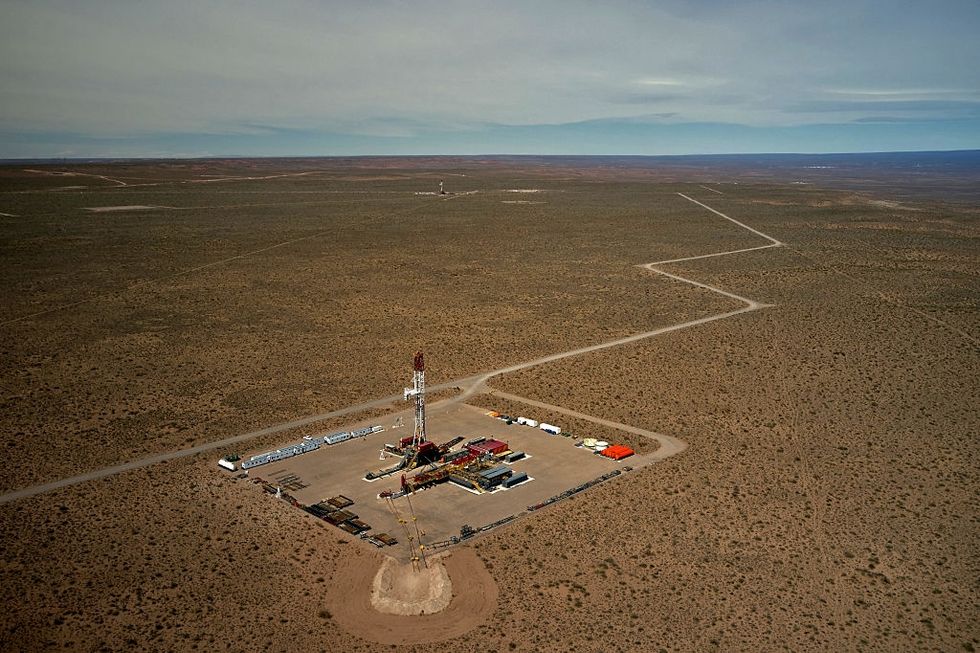 The Campo Maripe drilling site in the Vaca Muerta formation. Emiliano Lasalvia / AFP via Getty Images