You’re out of free articles.
Log in
To continue reading, log in to your account.
Create a Free Account
To unlock more free articles, please create a free account.
Sign In or Create an Account.
By continuing, you agree to the Terms of Service and acknowledge our Privacy Policy
Welcome to Heatmap
Thank you for registering with Heatmap. Climate change is one of the greatest challenges of our lives, a force reshaping our economy, our politics, and our culture. We hope to be your trusted, friendly, and insightful guide to that transformation. Please enjoy your free articles. You can check your profile here .
subscribe to get Unlimited access
Offer for a Heatmap News Unlimited Access subscription; please note that your subscription will renew automatically unless you cancel prior to renewal. Cancellation takes effect at the end of your current billing period. We will let you know in advance of any price changes. Taxes may apply. Offer terms are subject to change.
Subscribe to get unlimited Access
Hey, you are out of free articles but you are only a few clicks away from full access. Subscribe below and take advantage of our introductory offer.
subscribe to get Unlimited access
Offer for a Heatmap News Unlimited Access subscription; please note that your subscription will renew automatically unless you cancel prior to renewal. Cancellation takes effect at the end of your current billing period. We will let you know in advance of any price changes. Taxes may apply. Offer terms are subject to change.
Create Your Account
Please Enter Your Password
Forgot your password?
Please enter the email address you use for your account so we can send you a link to reset your password:
A Q&A with Villanova’s Stephen M. Strader on the legacy of Hurricane Andrew, unsustainable development, and why building codes alone aren’t enough.

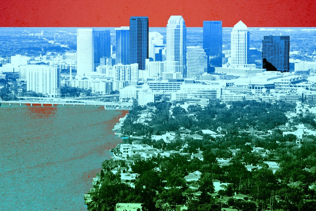
In around 12 hours, Hurricane Milton is set to make landfall within miles of Tampa Bay, a region that is home to more than 5 million people. Once a sleepy retirement community, the area has seen a major development boom in recent years fueled by Millennials and Gen Zers seeking the perks of coastal living; it was the 11th fastest-growing city of its size in the U.S. as of this spring and has been expected to continue to grow at nearly twice the rate of the rest of the country over the next five years. A third of those residents, including many of the newcomers, live in low-lying neighborhoods now under urgent evacuation notices due to the threat of “unsurvivable” storm surge, which could rise up to 15 feet.
The development boom that has made Tampa Bay so desirable is also why it’s particularly vulnerable. In an analysis of Hurricane Ian — the most expensive storm in Florida’s history, which struck just south of Milton’s projected track in 2022 — the re-insurance company Swiss Re found that if the storm had struck in the 1970s, it would have caused a third to a half as much damage. Simply put: You can’t adapt your way out of a hurricane problem.
If there is anyone to talk to about the vulnerabilities unique to Tampa Bay, it’s Stephen M. Strader, an associate professor and hazard geographer at Villanova University. Our conversation has been edited and condensed for clarity.
You shared an image on Twitter of the explosive growth in the Tampa Bay area between 1940 and 2024. Why does this make the region vulnerable to a storm like Milton? Is it just about there being more people there?
When we think about disasters, we think of the intersection of three components: a violent event, like what we have with Milton; vulnerability, or what types of people could be in the path, which could be related to racial divides, age, and gender norms; and what a lot of my work focuses on, exposure.
Exposure is just the number of people or things that we care about — businesses, schools, and things like that — that are subject to losses if an event occurs. Florida is a great example of rapid urbanization since the 1900s, and it’s rapid development in a very hazard-prone region.
It can be easy for outsiders to sit back and wonder why anyone would buy a house on the water or on a barrier island near Tampa.
There are a lot of factors that come into play when you think about where we develop and why we develop certain locations. One of the biggest pressures that we see is that it’s desirable land: In the short term, people want to live near the water. It’s beautiful! People don’t think necessarily about the risk that comes with it because they’re too focused on their dream, which is to live near the ocean.
The other side of that is, from an economic standpoint, people see it as an opportunity to have businesses and to build condos. Developers see the land and think, “How much could I buy this for and sell it for with homes on it?” This really started back with Carl Fisher, who was famous for building the Indianapolis Motor Speedway. He was a thrill-seeker, but also a businessman and developer, and he loved to go to South Florida — which is now Miami Beach, and then was swamps and mangroves and not developed at all. And he thought, Hmm, this would be a great place for people to visit for vacations and experiences. He slowly started filling in the wetlands with sand. And that’s the history of Florida's development: It continued because this was very valuable land.
There is a lot of socioeconomic pressure to develop in these areas, but we’re also starting to see it change. Those pressures are lessening because you have insurance industries now and events like this year after year.
There is another issue in Southwest Florida, which is that many of the homes were constructed before building codes were updated, right?
I tend to do a lot more work on the manufactured housing side. Before 1974, all manufactured homes were called mobile homes, and there wasn’t really a standard. Then, in 1974, the United States Department of Housing and Urban Development came in and said, “We need to increase the standards,” and they did.
Fast-forward to 1992 and Hurricane Andrew, and they realized these codes were not strong enough. Many people lived in manufactured homes that were destroyed by Andrew, which was a very windy hurricane. We think hurricanes are wind threats because of Andrew, but hurricanes are water threats, and most deaths occur because of that water. Andrew was the opposite.
Between 1992 and 1994, they updated building codes for manufactured housing, and actually, along the coastline, Florida has some of the strongest codes for manufactured homes in the country. A lot of the areas that will be affected by Milton will have those strong standards. But many homes were also grandfathered in if they were built before that time.
That’s just one type of housing. My guess is that when you have a lot of rapid development since the 1990s — well, I have some questions about structural integrity since building codes can be strong but they might not be followed. And we sometimes don’t know until afterwards. A lot of what is being built are condos or McMansions — it’s basically, How fast can you build them, how cheap can you build them, and how high can you sell them? And they look great until their performance is put into question.
Insurance companies are starting to see this and ask, “How do we retrofit structures?” Structure-wise, though, I think Tampa is in a decent spot. The problem is, the water is so powerful that it’s not going to matter.
What kinds of conversations do you think Floridians should be having about development or potential redevelopment after Milton?
I’m a huge proponent of resisting the urge to build right back — the reason being that’s how you get repetitive losses. The hard part is, with a lot of insurance, if you have it, you only get provisions to build back the way you were. You don’t have the ability to improve. So what I end up telling people is, sometimes these disasters provide an opportunity to assess what we need to do from a planning standpoint. This is unsustainable development, and not just because of hurricanes, but because of rising sea levels and the stress on the environment. And unfortunately, a lot of these developments were built on top of wetlands and marshes and mangroves that used to protect the island areas as natural barriers.
The hard part is that people’s emotions are very strong after disasters, and they immediately want to return to how things were. That’s why you see people picking up the pieces the day after a storm, sometimes even when they’re injured. So we have to resist the urge as a group, and say, maybe this isn’t the time to think about rebuilding here.
Many wetland restoration projects in Florida are doing that very thing: reclaiming the environments that protected people inland. But on the other side you have developers and builders and local economies that rely on people coming to these areas, and that pressures people to come right back. Then you end up with a situation of repetitive losses and that’s why FEMA has been losing money over the years — it’s not so much that we’re putting money toward disasters but that we’re not getting value out of it, because it’s so much more likely for there to be impacts because of that exposure growth. Look at what happened after Helene and what’s going to happen with Milton: We’re splitting resources between the two. But we’re doing the best with the tools we have when there’s pressure on both sides, and considerations both economic and safety.
Is there anything else people should know about the geography of Tampa or the development risk there?
This storm is going to be different than other storms, and that’s because of the direction and intensity of it. The one thing we have to remember is that all that development — and everybody, for the most part, who isn’t 100 years old — has not experienced a hurricane of this magnitude in their life. That means everyone has the cognitive bias to say, “I’ve been through hurricanes before and was fine.” That is probably not going to be the case with this event; no one has been through this before.
What’s worrisome to me is that the trajectory of the hurricane is changing. A subtle shift north or south by 20 miles could mean a big difference for the Tampa region — if you have the right side of the hurricane push water into the Bay, it’s no different than 10 people jumping into a hot tub. The water level goes up and forces all that water into a smaller region, which is going to lead to more storm surge in Tampa Bay, Clearwater, and the St. Pete area. I don’t want to call it a “perfect storm,” but if you push all that water in there, you’re going to flood people in a way that hurricanes they’ve been through before never got close to. And I worry, if it goes south, about Fort Myers and the areas that were hit hard by Hurricane Ian. So it’s multilayered.
The good news that I’ll bring up is that we’re reeling from Helene, which means people have it in their brains about how bad this can be, which is probably causing more people to evacuate than normal. We have a problem with disaster amnesia in places where a hurricane hasn’t happened in a long time so “it’s not going to happen again.” And we forget. I remember Hurricane Katrina and what it did to New Orleans. It still has effects, but the students I’m teaching now weren’t even alive when it hit. These memories are short, and many people in Florida today weren’t there 30 years ago or 20 years ago. The only good thing to come out of Helene is that people are now aware of what can happen.

Log in
To continue reading, log in to your account.
Create a Free Account
To unlock more free articles, please create a free account.
This is an edition of Heatmap Daily, an evening review of the day’s news written by our executive editor. Sign up for it here.
El Niño is here.
The world’s largest ocean slipped into the weather pattern in the spring, according to the National Oceanic and Atmospheric Administration, and the sea surface is now significantly warmer than average in one important region. When you chart ocean temperatures on a map, the “El Niño tongue” (yes, that is what scientists call it) clearly appears:

It might be more accurate to describe El Niño as something that happens to the planet, though. The Pacific occupies about one-third of Earth’s surface. When that third becomes unusually warm, it transforms weather around the world, driving wetter conditions in California, Central America, and South America; and drier weather in Asia, Africa, and Australia.
So far, so normal. El Niño is a standard fluctuation in the Earth’s climate system; we experienced the last one in 2023 and 2024.
But that is roughly where what’s normal about this year’s El Niño ends.
For one, this El Niño is far more intense than we should expect at this time of year. In an El Niño, the Pacific’s average temperature usually rises through the end of December or so; the phenomenon’s original name in Spanish, El niño de Navidad, alluded to the surprising arrival of warm currents in South America around Christmas. In the modern satellite era, the warmest El Niño ever measured happened in 2015, and ocean temperatures peaked at 3.1 degrees Celsius in November and December of that year. We called that a “Super El Niño” for just how abnormal it was.
Yet the Pacific is already more than 2.6 degrees Celsius (or nearly 5 degrees Fahrenheit) above normal — making this the third strongest El Niño ever measured in the satellite era — and it is only August. We still have four months to go, and this El Niño is already a record-smasher. More ominously, models expect that this El Niño could eventually grow to more than 4 degrees Celsius, or 7 degrees Fahrenheit, above normal.
What will that mean for the world? According to a recent Science study, the average El Niño can cost the global economy more than $3 trillion. The world is richer now than it was a decade or two ago, which should make it better able to withstand disaster. But this El Niño is so far out of sample that it’s hard to know what it could do.
And perhaps more importantly — as the climate scientist Zeke Hausfather, the guest of our new episode of Shift Key says today — it will offer a kind of preview of what the planet’s normal climate will resemble a decade from now. This El Niño is likely to push 2027’s average temperature above 1.5 degrees Celsius, the nominal threshold at which countries hoped to limit warming as part of the Paris Agreement (although, as you’ll hear, it is slightly more complicated than that).
Which is all to say: I encourage you to listen to our new episode, which is available on Apple, Spotify, or RSS. (A transcript is also available for Heatmap subscribers.) We tackle questions including:
There’s one thought that I didn’t include in the episode, however. Since late 2023, political discussion of climate change has decreased. This isn’t a phenomenon limited to any one faction of the Democratic Party — the progressives Abdul El-Sayed and Zohran Mamdani have downplayed climate policy roughly as much as, say, moderates like Mary Peltola and James Talarico have — but it is a clear trend. The American media’s coverage of climate change has declined during the same period. This “climate hushing” is not because politicians stopped caring per se, I think, but because nobody is sure how to talk about the issue in a politically useful way anymore, especially after the “climate = jobs” rhetoric that underpinned the Biden administration’s policy failed to retain voters in 2024.
I don’t believe (and think that political science has disproven) that extreme weather can “awaken” the public to climate change. Even against a gradually warming baseline, the weather — and public attention — shift far too often for that. But media coverage is loosely responsive to events. When the super El Niño of 2015 and 2016 smashed the then-record for the hottest year ever measured, it helped initiate a new era of public and elite concern about climate change. That El Niño’s heat waves, wildfires, and mass coral bleaching previewed the far worse disasters of the decade that followed. This El Niño’s disasters and broken temperature records could be worse — and even less ignorable.
On copper prices, nuclear’s jellyfish woes, and Leo DiCaprio’s Chilean NIMBYism
Current conditions: The death toll from Colombia’s earthquake has risen beyond 250 • A severe thunderstorm flipped a car in Columbus, Ohio, as a large system swept across the Midwest • A partial solar eclipse is set to occur the Northeast.

David Crowley, a moderate Democrat and local official in Milwaukee, narrowly defeated Francesca Hong, a leftist state lawmaker and former ramen chef, in the Democratic gubernatorial primary in Wisconsin last night. The race marked one of the most significant tests of Democratic voters’ willingness to elect a member of the ascendant Democratic Socialists of America, now the most popular socialist group in U.S. history. Her campaign promised to make childcare and school lunches free, repeal anti-union laws, and give renters more protections against eviction. She also pitched what she called her “control-alt-delete” plan to eliminate tax credits for data centers and put a statewide moratorium on permits for new artificial intelligence facilities.
Ahead of Tuesday’s primary, the AI developers Vantage, Oracle, and OpenAI announced a $60,000 community investment in Port Washington, which my colleague Jael Holzman described as “the most controversial data center development area in the state.”
Just last week, the Trump administration agreed to pay the energy giant RWE more than $1.2 billion to abandon an offshore wind project, the latest in a series of deals in which taxpayers hand over billions to not receive new sources of clean electricity they badly need. On Tuesday, Senators Alex Padilla, the California Democrat, and Angus King, the independent from Maine, introduced a bill that would give companies that reject Trump’s payouts an expedited route to more development. “The Trump Administration is doing everything it can to kill California’s offshore wind future, handing energy companies billions of taxpayer dollars to walk away from projects that would have powered millions of homes,” Padilla said in a press release. “This bill makes sure their destructive approach doesn’t waste what’s already been invested so we can get these leases back to work, create the jobs Trump killed, and keep energy bills low for working families instead of letting his war on renewables cost Californians even more.”
The bill has one potential flaw, other than the fact that Republicans are unlikely to pass it and President Donald Trump is even less likely to sign it. That, as my colleague Robinson Meyer wrote this week, is that the roughly $4 billion in payouts so far went to projects that were “already dead or dying.” The money spent, in other words, is “for nothing.”
Please read the following two sentences in the tone of the famous scene of Tony Soprano defending Christopher Columbus: In this newsletter, Ea-nāṣir, the Mesopotamian copper merchant from Bronze Age-era Ur whose stone-carved complaints about a subpar metal shipment remain readable millennia later, is a hero. End of story! Why, you might ask? Because we are once again living through an age where copper, the basic building block of all things electric, is in high demand. Copper soared back to within half a cent of its record high Tuesday of nearly $14,000 per metric ton after an outage at a major smelter in Indonesia rattled global prices, Mining.com reported.
The fight over North America’s only major cobalt refinery, meanwhile, is heating up. The mining giant Glencore made a bid for control of Sherritt International, which has taken a beating from U.S. sanctions due to its 50% stake in Moa, a joint venture with the Cuban government. The joint venture’s assets include the Canadian refinery and Moa nickel-cobalt mine in Cuba. The Glencore-backed consortium is up against Gillon Capital, the family office of Ray Washburne, a Republican fundraiser and former Trump official, according to the Financial Times.
Sign up to receive Heatmap AM in your inbox every morning:
Weeks after Europe’s latest heat wave forced inland nuclear stations to pare down output for lack of cooling water in the continent’s rivers, a “massive influx” of jellyfish has forced France’s EDF to shut down three units at its Gravelines nuclear station and cut power from a fourth. That’s taken at least 3.2 gigawatts of capacity offline, Bloomberg reported, right as temperatures are expected to surpass 104 degrees Fahrenheit in the coming days. The unusually hot temperatures off France’s shores have encouraged jellyfish populations to “bloom,” clogging the pumping stations through which coastal nuclear plants like Gravelines pull in cooling water.
In Egypt, meanwhile, construction crews working on the country’s first nuclear station hit a critical milestone. The containment vessel for the Russian-designed El Dabaa plant’s first unit is nearly completed, according to World Nuclear News.
Digging deep enough into the bedrock around New York City to tap into lava-hot rocks for electricity production is probably still years away, despite the progress that next-generation geothermal companies such as Fervo Energy have recently made. But thermal networks that maintain a steady environment year-round by circulating air at a constant temperature are increasingly popular ways for New Yorkers in private homes outside the city to stay warm in winter and cool in summer. Now the city itself is seeing whether a large-scale version could work for the subway system and municipal buildings. A study is set to begin soon into whether a thermal energy network could be built along subway routes to capture, store, and redirect excess heat that accumulates in the Brooklyn Bridge-City Hall and Chambers Street station complex to municipal buildings above ground. “Radiant cooling technology will absorb heat from the subway platforms and transfer it to geothermal boreholes drilled beneath Chambers Street,” reporter Carlo Cariaga wrote for Think Geo Energy. “This excess heat will then be stored underground until it can be used for supply to nearby municipal buildings during winter.” The contract for the feasibility study is due to be awarded in the fall, with work scheduled to start in early 2027.
“It seems like it’s a good place to test geothermal solutions because it sounds like there is a part of the tracks that isn’t being used, so they don’t have to stop service,” Jack Klein, the citizen researcher who conducted his own gonzo Subway heat study last year, told my colleague Jeva Lange this week.
Leonardo DiCaprio has long been a major donor to environmental causes. But rarely has the actor taken as clear a stance against green development if it comes at any ecological cost as this. On Tuesday, Bloomberg reported that the Oscar winner had told his nearly 60 million Instagram followers that fewer than 1,000 Pehuenche spiny-chest frogs remain in the wild, and that construction of the proposed Chile-Argentina transmission line threatens the amphibians’ habitat. “Conservationists are not asking for the transmission project to be stopped,” the celebrity wrote in the post over the weekend. “They are asking for it to be built where it does not put a Critically Endangered species at even greater risk.”
Rob checks in on this season’s supercharged ocean temperatures with climate researcher Zeke Hausfather.
Every few years, the Pacific Ocean’s surface waters become especially warm near the equator, a climatic phenomenon known as El Niño.
El Niño is a normal part of the climate system, but even in a normal year, it can trigger extreme weather around the world. Forecasters are worried that the current El Niño — which just began a few weeks ago — is going to be anything but normal. Models suggest that we could soon see the hottest El Niño ever measured, with unpredictable and catastrophic effects for ecosystems and societies around the world.
What does that mean? And why does this El Niño look so bad? On this episode of Shift Key, Rob is joined by Zeke Hausfather, a climate research lead at Stripe and a research scientist at Berkeley Earth. They discuss what forecast models are saying about this El Niño, why it gives us a glance at the future, and whether climate change itself is accelerating.
Shift Key is hosted by Robinson Meyer, the founding executive editor of Heatmap News.
Subscribe to “Shift Key” and find this episode on Apple Podcasts, Spotify, Amazon, or wherever you get your podcasts.
You can also add the show’s RSS feed to your podcast app to follow us directly.
Here is an excerpt from their conversation:
Robinson Meyer: How much, at this point, are we in an El Niño that is record-breaking? Like, how much do we see in observations, physical observations of the ocean or the atmosphere and the rest of the climate system, and how much do we think from the models that it is going to get even hotter?
Zeke Hausfather: So the way that we track the strength of an El Niño — there’s a few different ways to track it. But the most common one is from this particular region of the tropical Pacific called the Niño 3.4 region, which is sort of like about a third of the way into the Pacific off the coast of Chile, right around the equator. And that’s where this tongue of warm water forms during El Niño events. That’s sort of the characteristic signal of El Niños. And temperatures in that region, as of today, are at 2.8 degrees centigrade above normal, normal meaning the average of the last 30 years. So it’s sort of a sliding window that tries to remove some of the human-caused warming.
Robinson Meyer: Are we comparing temperatures from that region to another region? Or they’re just in that region two or more degrees above normal?
Zeke Hausfather: So it’s a good question. The traditional way that El Niño has been defined is to just compare that region to itself, but with a 30-year moving average applied to remove the effects of human-caused warming. There is another metric that was introduced by NOAA last year called the Relative El Niño Index, which is a variant where you sort of subtract out the average over the tropical ocean as a whole from that region, so you’re looking at the difference between that region and the rest of the tropics.
There’s pros and cons of that approach. Arguably, it removes the human warming signal a bit better, but it also can overly penalize really strong El Niño events that reach outside of that region because they start warming the whole tropics. So anyway, the details are technical, but the point on the observations is that we’re already seeing a very strong event occurring there today. You know, temperatures as of today, when we’re recording, August 10, are 2.8C above normal. To put that in perspective, the strongest ever anomalies we’ve recorded, at least daily in the satellite record since the 1980 or so, were in 2015, 2016, and those were about 3.1 degrees above normal. And so as of today, by itself, it would be the third strongest El Niño signal ever recorded in that region.
But what’s different is that El Niño almost always peaks near the end of the year. So if you look at all the El Niño events on record, there’s been one or two that have peaked in October, but the vast majority peak in November or December, and a couple as late as January. It’s a very persistent pattern of these events. And so the fact that it’s only the beginning of August now and we’re already at this extremely high level, we’re essentially running two to three months ahead of any other El Niño on record in terms of how quickly it’s developing, which is one of the reasons why we’re increasingly convinced that this is going to be a record-setting event. It’s going to blow any event we’ve seen previously out of the water. And if you look at the latest models that came out this morning, actually, it’s good timing. They’re predicting a peak of around 4C in the Niño 3.4 region, which will be, you know, more than a degree above the previous record and could end up being the strongest El Niño in 500 or 1,000 years. We don’t have great proxy estimates going back, but, it certainly is something well outside of anything we’ve seen since records began in 1850.
Robinson Meyer: The swimmer Katie Ledecky swims a race sometimes in the Olympics and she’ll be out swimming and then behind her there’s a computer-generated line which is the current world record, and she’s way out in front of the current world record, and you’re watching her and then she does she turns around in the pool and then the world record is behind her. That is the current El Niño. This is the Katie Ledecky-style El Niño.
You can find a full transcript of the episode here.
Mentioned:
NOAA’s El Niño page and the relative El Niño index
An Assessment of Earth's Climate Sensitivity Using Multiple Lines of Evidence, the 2020 paper where Zeke was a coauthor
Zeke’s blog post on AI emissions: The real energy use of agentic AI
John Bistline’s post on AI emissions at Watershed
Heatmap’s coverage of AI emissions: A New Guesstimate for Corporate AI Emissions
This episode of Shift Key is sponsored by ...
Discover the Yale Clean and Equitable Energy Development online certificate program at the Yale Center for Business and the Environment. In this fully online, 5-month program, you’ll learn from leading experts, develop practical skills, and grow a powerful network. Visit cbey.yale.edu to learn more and apply.
Music for Shift Key is by Adam Kromelow.