Last week, I spoke with researcher Andra Garner about how hurricanes are increasingly sneaking up on us. She had recently published a new study in Scientific Reports, which found that Atlantic hurricanes are “more than twice as likely to strengthen from a weak Category 1 hurricane to a major Category 3 or stronger hurricane in a 24-hour period than they were between 1970 and 1990.”
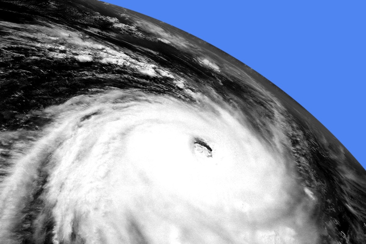
In her comments to me, Garner had stressed that “when storms intensify quickly, they can become more difficult to forecast and to plan for in terms of emergency action plans for coastal residents.” Less than a week later, her warning has seemingly come true in the form of Hurricane Otis, which made landfall near Acapulco, Mexico, on Wednesday morning as a record-breaking Category 5 storm. It had intensified from a tropical storm in a mere 12 hours and taken meteorologists almost completely by surprise.
On Wednesday, I checked back in with Garner about how Hurricane Otis factors into her research. Our correspondence via email has been lightly edited and condensed, below.
Would you expect similar results to your Atlantic hurricane intensification findings if you were to look at the northern East Pacific, where Otis formed? Or are there different trends to account for in the region?
While my work did focus on the Atlantic, rather than the Pacific, there are certain physical factors that are very favorable for hurricane formation, regardless of where you are in the world. Warm ocean waters are one of those factors, and Hurricane Otis certainly had plenty of warm ocean water.
Typically, the minimum ocean water temperature that can support hurricane formation and strengthening is 26 degrees Celsius (about 79 degrees Fahrenheit); last night, as Otis moved towards land, the storm was traveling over a patch of water that was near 31 degrees Celsius (about 88 degrees Fahrenheit) — substantially warmer than necessary, and plenty warm enough to support quick strengthening. Considering those kinds of factors, I think what we saw with Hurricane Otis lines up pretty well with what my research suggests that we should expect in a warmer climate.
You mentioned to me last week that future projections were outside the scope of this research, but if single-day intensification is more than twice as likely now as it was between 1970 and 1990, is there any reason to think it won’t be twice as likely again by, say, 2070?
This is a great question. I think that what my work shows is that, if we don’t change anything about our behavior, it is reasonable to expect that we might expect this trend to continue and to possibly worsen. In my research, across the time periods 1971-1990 and 2001-2020, the speed and degree of hurricane intensification were significantly different. While more research would be needed to really discern all the potential factors causing that strengthening to occur, I think that, to the extent that warmer ocean waters are involved, we could expect more of the same if we don’t limit our emissions moving forward.
I was pretty shocked to see in Acapulco exactly what you’d warned about in your email to me last week: that there is an “increased risk of hazards for our coastal communities” because of the difficulty of preparing for a storm that jumps from a tropical storm to a Category 5 in less than 24 hours. You spoke a little about this before, but would there be anything you’d want to add now that we’ve seen what you warned about actually unfold?
I’d just say that, as you mentioned, it is surprising to see this happen so soon after publishing research that really tells us this is what we might expect. I think knowing that something is expected because of a warming climate, and actually seeing it play out before your eyes, are two different things. Even though I have the data and the analyses to tell me that this is what we should expect, it’s still a little mind-boggling to see a storm like Otis transform from a Tropical Storm into a Category 5 hurricane in about 12 hours.


 Feel the Burnham. Carl Court/Getty Images


