You’re out of free articles.
Log in
To continue reading, log in to your account.
Create a Free Account
To unlock more free articles, please create a free account.
Sign In or Create an Account.
By continuing, you agree to the Terms of Service and acknowledge our Privacy Policy
Welcome to Heatmap
Thank you for registering with Heatmap. Climate change is one of the greatest challenges of our lives, a force reshaping our economy, our politics, and our culture. We hope to be your trusted, friendly, and insightful guide to that transformation. Please enjoy your free articles. You can check your profile here .
subscribe to get Unlimited access
Offer for a Heatmap News Unlimited Access subscription; please note that your subscription will renew automatically unless you cancel prior to renewal. Cancellation takes effect at the end of your current billing period. We will let you know in advance of any price changes. Taxes may apply. Offer terms are subject to change.
Subscribe to get unlimited Access
Hey, you are out of free articles but you are only a few clicks away from full access. Subscribe below and take advantage of our introductory offer.
subscribe to get Unlimited access
Offer for a Heatmap News Unlimited Access subscription; please note that your subscription will renew automatically unless you cancel prior to renewal. Cancellation takes effect at the end of your current billing period. We will let you know in advance of any price changes. Taxes may apply. Offer terms are subject to change.
Create Your Account
Please Enter Your Password
Forgot your password?
Please enter the email address you use for your account so we can send you a link to reset your password:
Stumpy stands alone.
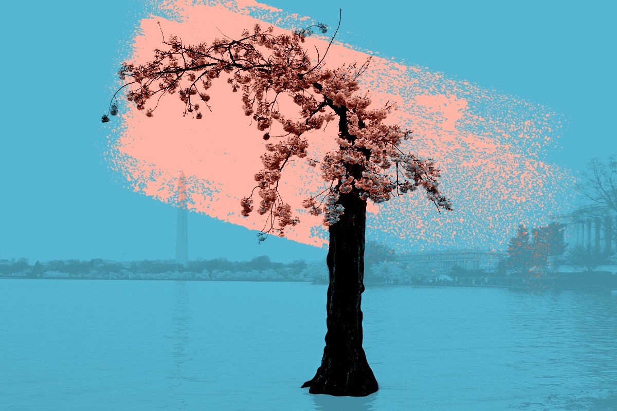
It’s hard to miss, rising scraggily up from the soil on the southeast side of the Tidal Basin in Washington, D.C. It picturesquely frames the Washington Monument with an outstretched limb, which also happens to be its only limb.
Stumpy is a Yoshino Cherry tree, a Prunus x yedoensis, one of the thousands that line the water of the Tidal Basin, and it’s been having a bit of a rough time lately. The nearby seawall, built 80-odd years ago, has slowly been settling into the mud and the muck, dropping about three feet in the time since it was built. High tide is also a foot higher now, and twice a day Stumpy’s roots are inundated with brackish water that’s saltier than the nearby Potomac River — a state of being that is no good for a tree. The trunk looks mostly hollow, like someone took a few large scoops out of it. All but one of the branches have rotted away and been trimmed by its caretakers at the National Park Service, leaving Stumpy with a windblown toupee of sticks, leaves, and buds.
Naturally, people are obsessed.
“This is my ninth cherry blossom season and I would be hard pressed to find another tree that’s gotten either a name or that sort of fame,” said Mike Litterst, Chief of Communications for the National Parks Service and Stumpy’s de facto spokesman. “People are literally lining up to take photos with it this year, and somebody’s even got Stumpy t-shirts now.”
Stumpy’s story began as a Reddit post in 2020, when a user said the tree was “as dead as my love life.” Stumpy is, of course, still kicking, and the Redditor met a girl, but for reasons unknown to everyone including the National Parks Service, the tree has been more popular this year than ever before. Perhaps D.C. was primed for Stumpy’s resurgence; back in December, residents of the Columbia Heights neighborhood became similarly obsessed with a diminutive Christmas tree they’d nicknamed Tiny Timber.
We like to tell stories about trees, and lately I’ve noticed them cropping up more often. Perhaps this is just frequency bias, the detritus of spending the early pandemic in a house with a maple tree in the backyard, where for the first time in my life I found myself paying attention to arboreal rhythms as the seasons changed. But we all, to some extent, became amateur naturalists in lockdown, and the trees (and the birds) are what remain.
Stumpy and Tiny Timber both belong to the Charlie Brown class of trees, the ones that, because of their smallness and sadness and apparent untree-ness, evoke a kind of empathy that allows us to give human emotions to them. Litterst thinks this is why Stumpy is so popular this year — it’s an underdog, and we like underdog stories.
Then there are the stories of magic and majesty, like The Giving Tree and the Kalaloch Tree of Life in Washington State and The Overstory, winner of the 2019 Pulitzer Prize in Fiction. These are the trees that make us feel small; we gape at their stoic enormity, the generosity with which they share their shade. I think these are the same reasons why tree planting is such a popular, if misguided, climate solution: We are so drawn to the idea of trees being older and wiser than us, we take such comfort in their leaves and branches, that we can’t help but hope they will fix our mistakes for us.
They won’t, of course, and perhaps we ought to reexamine our expectations of trees. Their effects on our planet are matters of circumstance rather than agency; trees, after all, may have accidentally killed off half the planet when they evolved roots a few hundred million years ago. They didn’t know what they were doing then, and they don’t now — an idea I find somewhat freeing, for it lets a tree simply be a tree.
Take Stumpy. Peak bloom was over by the time I made the pilgrimage to see Stumpy for myself: Its flowers and the crowds were both gone, although one couple briefly stopped on their walk to quickly chuckle at Stumpy before continuing.
There’s a sort of solemn quietude to Stumpy without the crowds. There were other, more conventionally beautiful cherry trees nearby, a few of them still hanging onto their pink and white flowers. But Stumpy, standing by the water on its own, with its one lone branch pointing towards the Washington Monument, bucked the trend, as if someone had dropped in a bonsai among the rest.
It reminded me a bit of another out-of-place plant I’d seen, back in 2019, when a tomato sprouted in a wooden piling in the East River, just off Brooklyn Bridge Park. That, too, was the kind of thing that made people stop and point and laugh, but with the kind of laugh one emits when they crawl to the edge of a cliff and look out at the sea yawning below. An errant seed or a stubborn tree: These are conduits for wonder, whispers of the ecosystems we inhabit.
They’re also reminders of our roles as stewards. Despite how it looks, the fact that Stumpy flowered means it’s in pretty good shape overall, Litterst told me, and the parts of the trunk that deliver nutrients to and from the remaining branch are still working as they should. Plans for a new, improved seawall — one that’s embedded in the bedrock unlike its predecessor, so it doesn’t sink — are in the works, with construction planned to begin next year. The National Parks Service doesn’t know how long Stumpy has left, but if it manages to hold out until the seawall is finished it’ll eventually be spared the rising tides and could live to see some of its brethren take their places alongside it.
I’m sure they’ll be pretty, in the way cherry blossoms always are. But I’ll still be going back for Stumpy.
Log in
To continue reading, log in to your account.
Create a Free Account
To unlock more free articles, please create a free account.
Why killing an EPA climate database could essentially gut a tax credit
The Trump administration’s bid to end an Environmental Protection Agency program may essentially block any company — even an oil firm — from accessing federal subsidies for capturing carbon or producing hydrogen fuel.
On Friday, the Environmental Protection Agency announced that it would stop collecting and publishing greenhouse gas emissions data from thousands of refineries, power plants, and factories across the country.
The Trump administration argues that the 10-year-old scheme, known as the Greenhouse Gas Reporting Program, costs more than $2 billion and isn’t legally required under the Clean Air Act. Lee Zeldin, the EPA administrator, described the program as “nothing more than bureaucratic red tape that does nothing to improve air quality.”
But the program is more important than the Trump administration lets on. It’s true that the policy, which required more than 8,000 different facilities around the country to report their emissions, helped the EPA and outside analysts estimate the country’s annual greenhouse gas emissions.
But it did more than that. Over the past decade, the program had essentially become the master database of carbon pollution and emissions policy across the American economy. “Essentially everything the federal government does related to emissions reductions is dependent on the [Greenhouse Gas Reporting Program],” Jack Andreasen Cavanaugh, a fellow at the Center on Global Energy Policy at Columbia University, told me.
That means other federal programs — including those that Republicans in Congress have championed — have come to rely on the EPA database.
Among those programs: the federal tax credit for capturing and using carbon dioxide. Republicans recently increased the size of that subsidy, nicknamed 45Q after a section of the tax code, for companies that turn captured carbon into another product or use it to make oil wells more productive. Those changes were passed in President Trump’s big tax and spending law over the summer.
But Zeldin’s scheme to end the Greenhouse Gas Reporting Program would place that subsidy off limits for the foreseeable future. Under federal law, companies can only claim the 45Q tax credit if they file technical details to the EPA’s emissions reporting program.
Another federal tax credit, for companies that use carbon capture to produce hydrogen fuel, also depends on the EPA’s greenhouse gas reporting. That subsidy hasn’t received the same friendly treatment from Republicans, and it will now phase out in 2028.
The EPA program is “the primary mechanism by which companies investing in and deploying carbon capture and hydrogen projects quantify the CO2 that they’re sequestering, such that they qualify for tax incentives,” Jane Flegal, a former Biden administration appointee who worked on industrial emissions policy, told me. She is now the executive director of the Blue Horizons Foundation.
“The only way for private capital to be put to work to deploy American carbon capture and hydrogen projects is to quantify the carbon dioxide that they’re sequestering, in some way,” she added. That’s what the EPA program does: It confirms that companies are storing or using as much carbon as they claim they are to the IRS.
The Greenhouse Gas Reporting Program is “how the IRS communicates with the EPA” when companies claim the 45Q credit, Cavanaugh said. “The IRS obviously has taxpayer-sensitive information, so they’re not able to give information to the EPA about who or what is claiming the credit.” The existence of the database lets the EPA then automatically provide information to the IRS, so that no confidential tax information is disclosed.
Zeldin’s announcement that the EPA would phase out the program has alarmed companies planning on using the tax credit. In a statement, the Carbon Capture Coalition — an alliance of oil companies, manufacturers, startups, and NGOs — called the reporting program the “regulatory backbone” of the carbon capture tax credit.
“It is not an understatement that the long-term success of the carbon management industry rests on the robust reporting mechanisms” in the EPA’s program, the group said.
Killing the EPA program could hurt American companies in other ways. Right now, companies that trade with European firms depend on the EPA data to pass muster with the EU’s carbon border adjustment tax. It’s unclear how they would fare in a world with no EPA data.
It could also sideline GOP proposals. Senator Bill Cassidy, a Republican from Louisiana, has suggested that imports to the United States should pay a foreign pollution fee — essentially, a way of accounting for the implicit subsidy of China’s dirty energy system. But the data to comply with that law would likely come from the EPA’s greenhouse gas database, too.
Ending the EPA database wouldn’t necessarily spell permanent doom for the carbon capture tax credit, but it would make it much harder to use in the years to come. In order to re-open the tax credit for applications, the Treasury Department, the Energy Department, the Interior Department, and the EPA would have to write new rules for companies that claim the 45Q credit. These rules would go to the end of the long list of regulations that the Treasury Department must write after Trump’s spending law transformed the tax code.
That could take years — and it could sideline projects now under construction. “There are now billions of dollars being invested by the private sector and the government in these technologies, where the U.S. is positioned to lead globally,” Flegal said. Changing the rules would “undermine any way for the companies to succeed.”
Ditching the EPA database, however, very well could doom carbon capture-based hydrogen projects. Under the terms of Trump’s tax law, companies that want to claim the hydrogen credit must begin construction on their projects by 2028.
The Trump administration seems to believe, too, that gutting the EPA database may require new rules for the carbon capture tax credit. When asked for comment, an EPA spokesperson pointed me to a line in the agency’s proposal: “We anticipate that the Treasury Department and the IRS may need to revise the regulation,” the legal proposal says. “The EPA expects that such amendments could allow for different options for stakeholders to potentially qualify for tax credits.”
The EPA spokesperson then encouraged me to ask the Treasury Department for anything more about “specific implications.”
Paradise, California, is snatching up high-risk properties to create a defensive perimeter and prevent the town from burning again.
The 2018 Camp Fire was the deadliest wildfire in California’s history, wiping out 90% of the structures in the mountain town of Paradise and killing at least 85 people in a matter of hours. Investigations afterward found that Paradise’s town planners had ignored warnings of the fire risk to its residents and forgone common-sense preparations that would have saved lives. In the years since, the Camp Fire has consequently become a cautionary tale for similar communities in high-risk wildfire areas — places like Chinese Camp, a small historic landmark in the Sierra Nevada foothills that dramatically burned to the ground last week as part of the nearly 14,000-acre TCU September Lightning Complex.
More recently, Paradise has also become a model for how a town can rebuild wisely after a wildfire. At least some of that is due to the work of Dan Efseaff, the director of the Paradise Recreation and Park District, who has launched a program to identify and acquire some of the highest-risk, hardest-to-access properties in the Camp Fire burn scar. Though he has a limited total operating budget of around $5.5 million and relies heavily on the charity of local property owners (he’s currently in the process of applying for a $15 million grant with a $5 million match for the program) Efseaff has nevertheless managed to build the beginning of a defensible buffer of managed parkland around Paradise that could potentially buy the town time in the case of a future wildfire.
In order to better understand how communities can build back smarter after — or, ideally, before — a catastrophic fire, I spoke with Efseaff about his work in Paradise and how other communities might be able to replicate it. Our conversation has been lightly edited and condensed for clarity.
Do you live in Paradise? Were you there during the Camp Fire?
I actually live in Chico. We’ve lived here since the mid-‘90s, but I have a long connection to Paradise; I’ve worked for the district since 2017. I’m also a sea kayak instructor and during the Camp Fire, I was in South Carolina for a training. I was away from the phone until I got back at the end of the day and saw it blowing up with everything.
I have triplet daughters who were attending Butte College at the time, and they needed to be evacuated. There was a lot of uncertainty that day. But it gave me some perspective, because I couldn’t get back for two days. It gave me a chance to think, “Okay, what’s our response going to be?” Looking two days out, it was like: That would have been payroll, let’s get people together, and then let’s figure out what we’re going to do two weeks and two months from now.
It also got my mind thinking about what we would have done going backwards. If you’d had two weeks to prepare, you would have gotten your go-bag together, you’d have come up with your evacuation route — that type of thing. But when you run the movie backwards on what you would have done differently if you had two years or two decades, it would include prepping the landscape, making some safer community defensible space. That’s what got me started.
Was it your idea to buy up the high-risk properties in the burn scar?
I would say I adapted it. Everyone wants to say it was their idea, but I’ll tell you where it came from: Pre-fire, the thinking was that it would make sense for the town to have a perimeter trail from a recreation standpoint. But I was also trying to pitch it as a good idea from a fuel standpoint, so that if there was a wildfire, you could respond to it. Certainly, the idea took on a whole other dimension after the Camp Fire.
I’m a restoration ecologist, so I’ve done a lot of river floodplain work. There are a lot of analogies there. The trend has been to give nature a little bit more room: You’re not going to stop a flood, but you can minimize damage to human infrastructure. Putting levees too close to the river makes them more prone to failing and puts people at risk — but if you can set the levee back a little bit, it gives the flood waters room to go through. That’s why I thought we need a little bit of a buffer in Paradise and some protection around the community. We need a transition between an area that is going to burn, and that we can let burn, but not in a way that is catastrophic.
How hard has it been to find willing sellers? Do most people in the area want to rebuild — or need to because of their mortgages?
Ironically, the biggest challenge for us is finding adequate funding. A lot of the property we have so far has been donated to us. It’s probably upwards of — oh, let’s see, at least half a dozen properties have been donated, probably close to 200 acres at this point.
We are applying for some federal grants right now, and we’ll see how that goes. What’s evolved quite a bit on this in recent years, though, is that — because we’ve done some modeling — instead of thinking of the buffer as areas that are managed uniformly around the community, we’re much more strategic. These fire events are wind-driven, and there are only a couple of directions where the wind blows sufficiently long enough and powerful enough for the other conditions to fall into play. That’s not to say other events couldn’t happen, but we’re going after the most likely events that would cause catastrophic fires, and that would be from the Diablo winds, or north winds, that come through our area. That was what happened in the Camp Fire scenario, and another one our models caught what sure looked a lot like the [2024] Park Fire.
One thing that I want to make clear is that some people think, “Oh, this is a fire break. It’s devoid of vegetation.” No, what we’re talking about is a well-managed habitat. These are shaded fuel breaks. You maintain the big trees, you get rid of the ladder fuels, and you get rid of the dead wood that’s on the ground. We have good examples with our partners, like the Butte Fire Safe Council, on how this works, and it looks like it helped protect the community of Cohasset during the Park Fire. They did some work on some strips there, and the fire essentially dropped to the ground before it came to Paradise Lake. You didn’t have an aerial tanker dropping retardant, you didn’t have a $2-million-per-day fire crew out there doing work. It was modest work done early and in the right place that actually changed the behavior of the fire.
Tell me a little more about the modeling you’ve been doing.
We looked at fire pathways with a group called XyloPlan out of the Bay Area. The concept is that you simulate a series of ignitions with certain wind conditions, terrain, and vegetation. The model looked very much like a Camp Fire scenario; it followed the same pathway, going towards the community in a little gulch that channeled high winds. You need to interrupt that pathway — and that doesn’t necessarily mean creating an area devoid of vegetation, but if you have these areas where the fire behavior changes and drops down to the ground, then it slows the travel. I found this hard to believe, but in the modeling results, in a scenario like the Camp Fire, it could buy you up to eight hours. With modern California firefighting, you could empty out the community in a systematic way in that time. You could have a vigorous fire response. You could have aircraft potentially ready. It’s a game-changing situation, rather than the 30 minutes Paradise had when the Camp Fire started.
How does this work when you’re dealing with private property owners, though? How do you convince them to move or donate their land?
We’re a Park and Recreation District so we don’t have regulatory authority. We are just trying to run with a good idea with the properties that we have so far — those from willing donors mostly, but there have been a couple of sales. If we’re unable to get federal funding or state support, though, I ultimately think this idea will still have to be here — whether it’s five, 10, 15, or 50 years from now. We have to manage this area in a comprehensive way.
Private property rights are very important, and we don’t want to impinge on that. And yet, what a person does on their property has a huge impact on the 30,000 people who may be downwind of them. It’s an unusual situation: In a hurricane, if you have a hurricane-rated roof and your neighbor doesn’t, and theirs blows off, you feel sorry for your neighbor but it’s probably not going to harm your property much. In a wildfire, what your neighbor has done with the wood, or how they treat vegetation, has a significant impact on your home and whether your family is going to survive. It’s a fundamentally different kind of event than some of the other disasters we look at.
Do you have any advice for community leaders who might want to consider creating buffer zones or something similar to what you’re doing in Paradise?
Start today. You have to think about these things with some urgency, but they’re not something people think about until it happens. Paradise, for many decades, did not have a single escaped wildfire make it into the community. Then, overnight, the community is essentially wiped out. But in so many places, these events are foreseeable; we’re just not wired to think about them or prepare for them.
Buffers around communities make a lot of sense, even from a road network standpoint. Even from a trash pickup standpoint. You don’t think about this, but if your community is really strung out, making it a little more thoughtfully laid out also makes it more economically viable to provide services to people. Some things we look for now are long roads that don’t have any connections — that were one-way in and no way out. I don’t think [the traffic jams and deaths in] Paradise would have happened with what we know now, but I kind of think [authorities] did know better beforehand. It just wasn’t economically viable at the time; they didn’t think it was a big deal, but they built the roads anyway. We can be doing a lot of things smarter.
A war of attrition is now turning in opponents’ favor.
A solar developer’s defeat in Massachusetts last week reveals just how much stronger project opponents are on the battlefield after the de facto repeal of the Inflation Reduction Act.
Last week, solar developer PureSky pulled five projects under development around the western Massachusetts town of Shutesbury. PureSky’s facilities had been in the works for years and would together represent what the developer has claimed would be one of the state’s largest solar projects thus far. In a statement, the company laid blame on “broader policy and regulatory headwinds,” including the state’s existing renewables incentives not keeping pace with rising costs and “federal policy updates,” which PureSky said were “making it harder to finance projects like those proposed near Shutesbury.”
But tucked in its press release was an admission from the company’s vice president of development Derek Moretz: this was also about the town, which had enacted a bylaw significantly restricting solar development that the company was until recently fighting vigorously in court.
“There are very few areas in the Commonwealth that are feasible to reach its clean energy goals,” Moretz stated. “We respect the Town’s conservation go als, but it is clear that systemic reforms are needed for Massachusetts to source its own energy.”
This stems from a story that probably sounds familiar: after proposing the projects, PureSky began reckoning with a burgeoning opposition campaign centered around nature conservation. Led by a fresh opposition group, Smart Solar Shutesbury, activists successfully pushed the town to drastically curtail development in 2023, pointing to the amount of forest acreage that would potentially be cleared in order to construct the projects. The town had previously not permitted facilities larger than 15 acres, but the fresh change went further, essentially banning battery storage and solar projects in most areas.
When this first happened, the state Attorney General’s office actually had PureSky’s back, challenging the legality of the bylaw that would block construction. And PureSky filed a lawsuit that was, until recently, ongoing with no signs of stopping. But last week, shortly after the Treasury Department unveiled its rules for implementing Trump’s new tax and spending law, which basically repealed the Inflation Reduction Act, PureSky settled with the town and dropped the lawsuit – and the projects went away along with the court fight.
What does this tell us? Well, things out in the country must be getting quite bleak for solar developers in areas with strident and locked-in opposition that could be costly to fight. Where before project developers might have been able to stomach the struggle, money talks – and the dollars are starting to tell executives to lay down their arms.
The picture gets worse on the macro level: On Monday, the Solar Energy Industries Association released a report declaring that federal policy changes brought about by phasing out federal tax incentives would put the U.S. at risk of losing upwards of 55 gigawatts of solar project development by 2030, representing a loss of more than 20 percent of the project pipeline.
But the trade group said most of that total – 44 gigawatts – was linked specifically to the Trump administration’s decision to halt federal permitting for renewable energy facilities, a decision that may impact generation out west but has little-to-know bearing on most large solar projects because those are almost always on private land.
Heatmap Pro can tell us how much is at stake here. To give you a sense of perspective, across the U.S., over 81 gigawatts worth of renewable energy projects are being contested right now, with non-Western states – the Northeast, South and Midwest – making up almost 60% of that potential capacity.
If historical trends hold, you’d expect a staggering 49% of those projects to be canceled. That would be on top of the totals SEIA suggests could be at risk from new Trump permitting policies.
I suspect the rate of cancellations in the face of project opposition will increase. And if this policy landscape is helping activists kill projects in blue states in desperate need of power, like Massachusetts, then the future may be more difficult to swallow than we can imagine at the moment.