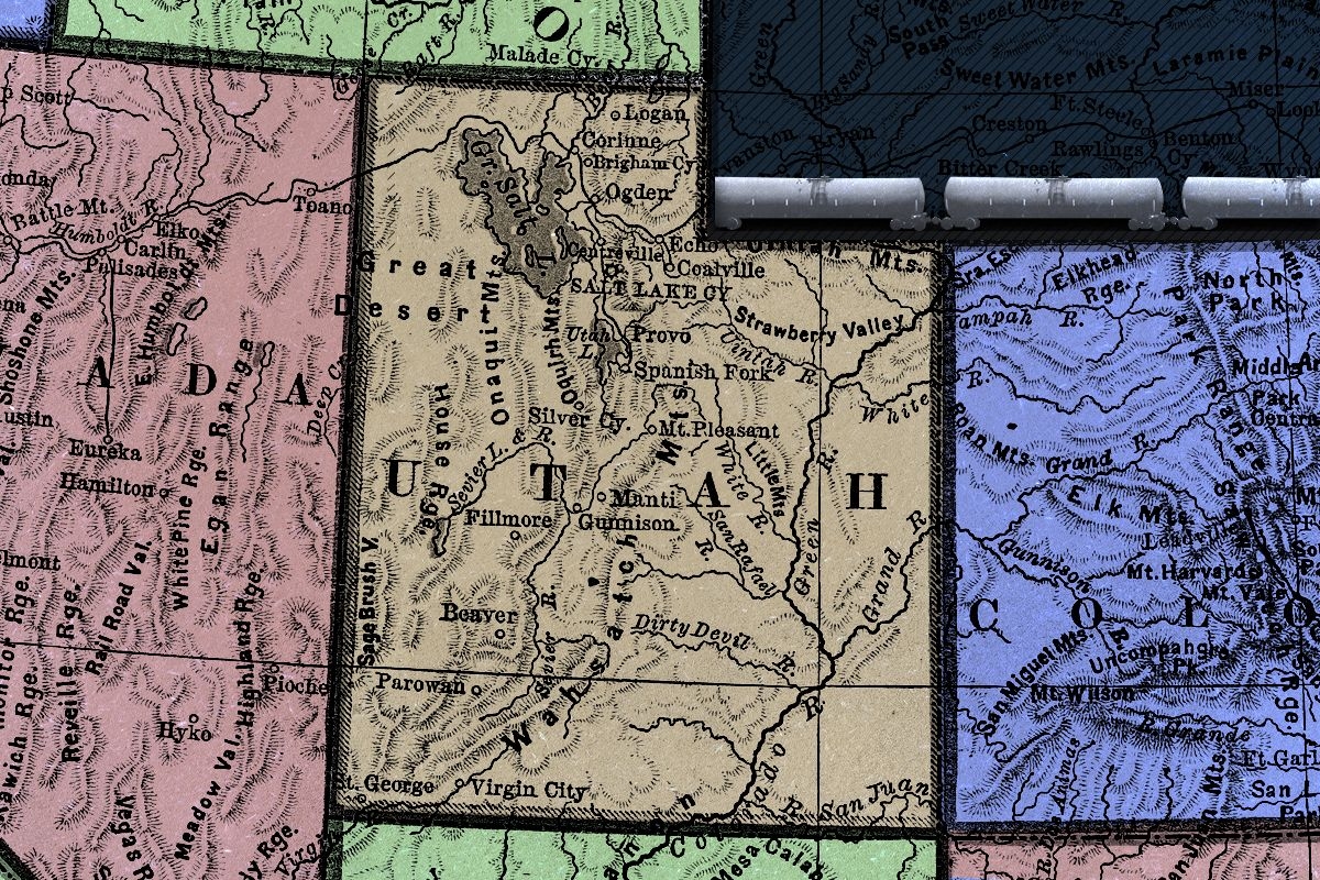
Every state would like to think itself singular but, truly, there is no place like Utah. The Beehive State has long fascinated outsiders; today, that attention is largely trained on Netflix exposés about the Church of Jesus Christ of Latter-day Saints, ballerina farmers, and Crumbl cookies, but historically, the obsession has been with its land. Utah has the nation’s highest density of National Parks; its rivers, canyons, mountains, and deserts have stirred Mark Twain, John Wesley Powell, John Muir, and Edward Abbey. To quote a more contemporary literary conduit, Post Malone: “It’s a free country out there. You can buy suppressors in Utah. You can … walk into the grocery store with a handgun on your hip. Cowboy shit.”
More recently, Utah has sought out a different source of outsider attention — that of the United States Supreme Court. Two lawsuits that originated in the state are currently under consideration by the justices. The first, Seven County Infrastructure Coalition v. Eagle County, Colorado, concerns the scope of the National Environmental Policy Act with regard to the construction of a railroad spur that would link Utah’s oil fields to the national rail lines. (Though the tracks would be in Utah, the connection would ultimately increase hazardous waxy crude oil shipments through the Colorado county in the case citation.) The second lawsuit, Utah v. the United States — which the court has yet to decide whether or not it will hear — involves the state suing the federal government over its allegedly unconstitutional control of “unused” lands by the Bureau of Land Management. If Utah prevails in the case, it could mean the vast reshaping of the American West, about 47% of which is federal land.
“Utah is all crazy, all the time right now,” Stephen Bloch, the legal director of the Southern Utah Wilderness Alliance, a conservation nonprofit opposing Utah v. the U.S., told me.
While not immediately apparent, there is nevertheless a strange logic to the two lawsuits that otherwise appear to have little to do with one another beyond the fact of their geography. At their core, both cases are ultimately about who gets to decide to do what with Utah’s land.
To anyone familiar with land use issues in the Mountain West, all of this is fairly routine. A strain of libertarianism and anti-government individualism runs through the more conservative inland Western states, coloring everything from the gun ownership policies so colorfully observed by Post Malone to whom the states back for president. Yet in the extent to which it is willing to pursue this common ideal, Utah is still an outlier.
“Westerners revere their public lands,” Betsy Gaines Quammen, a historian and author of American Zion: Cliven Bundy, God & Public Lands in the West, told me. “This is what makes the West the West — that you can come out and just go hiking, and you’re not trespassing.” Take the recent Montana Senate race, in which incumbent Democrat Jon Tester wielded his opponent Tim Sheehy’s comparatively mild comments about privatizing public lands as a cudgel in a deep red state. (Tester, it must be added, lost his reelection bid.) But in Utah, instead of celebrating federal land as the embodiment of this Western inheritance, its politicians are trying to eliminate them.
In the case of Utah, this goal is immediate and obvious. State officials claim that the 18.5 million acres of “unappropriated” BLM land in the state — that is, public lands not already designated as national parks, monuments, wilderness areas, national forests and conservation areas, or Tribal lands — are held in violation of the U.S. Constitution, which doesn’t explicitly authorize the federal government to hold land indefinitely. “Utah deserves priority when it comes to managing this land,” the state’s Republican Governor Spencer Cox said at a news conference in August, adding, “Utah is in the best position to understand and respond to the unique needs of our environment and communities.”
While Utah’s crown jewel, its “Mighty Five” National Parks, would remain under federal management, the state of Wyoming — which has backed Utah’s lawsuit in an amicus brief along with Idaho, Alaska, and the Arizona legislature — wants even more. “In Wyoming’s filing, they’re like, ‘Oh no, we’re in for everything,” Bloch said. “‘There shouldn’t be any federal land in Wyoming’ — including national parks.” More than 95% of Yellowstone National Park — the nation’s first national park, designated in 1872 — sits within Wyoming’s borders.
It seems doubtful that the Supreme Court will take up this case. For one thing, Utah is attempting to leapfrog the lower courts by taking its complaints directly to SCOTUS, a shortcut it says is justified by its concerns being “of profound importance not just to Utah, but to all the States in the Nation.” For another, President Biden’s Department of Justice has pointed out that what Utah seeks is outside the powers vested in the judicial branch; only Congress has decision-making authority over public lands. On the other hand, “Anyone right now, I think, would hesitate to say definitively, ‘Here’s what the Supreme Court will do,’” Aaron Weiss, the deputy director of the Center for Western Priorities, a nonpartisan conservation advocacy group, told me.
Seven County Infrastructure Coalition is a different story. Opponents of the railway claim that the government’s environmental review took into account the remote economic benefits of the railway — including induced employment, a notoriously inexact projection — while not equally weighing the indirect health impacts of the rail line, such as the pollution of additional fracking wells in the Uinta Basin or frontline communities near the refineries on the Gulf, where the crude oil is ultimately headed. The Supreme Court (minus Neil Gorsuch, who recused himself at the 11th hour) heard oral arguments in the case this week, however, and appears on track to rule that the government’s NEPA review for the railroad was sufficient. That would ultimately be a win for the Uinta Basin Railway and the business coalition that brought the suit after the U.S. Court of Appeals for the District of Columbia Circuit ruled there were flaws in the upstream and downstream analyses.
“I’m really worried that the court could end up inadvertently blessing this fundamentally arbitrary, imbalanced result, where an agency is allowed to talk about all the indirect benefits that they want — to go as far down the line, as far upstream, to the ends of the Earth chasing these indirect benefits — but not bother talking about the corresponding costs,” Jason Schwartz, the legal director at the Institute for Policy Integrity at New York University’s School of Law, told me. “That undermines the very purpose of NEPA, which was to present the public and decision-makers with a full and balanced view of both the economic and environmental perspectives.” (Schwartz authored an amicus brief for the Institute of Policy Integrity against the government’s NEPA review.)
A ruling that reaffirms the current scope of NEPA wouldn’t be a shock — the court has always sided with the government in such cases, E&E News notes. What’s different this time is that the plaintiffs presented the court with a third option, an avenue that would severely limit the scope of the NEPA’s environmental review process going forward by restraining agency considerations only to what falls under their immediate purview. Chief Justice John Roberts has sounded skeptical of this pitch so far; it’s this third path, however, that the oil and gas producer Anschutz submitted an amicus brief to the court to support, drawing attention to the fact that “far more is at stake … than the 88-mile rail line in rural Utah.” (The company’s owner, Philip Anchutz, has close ties to Gorsuch.)
“There are so many ways to make NEPA more efficient without arbitrarily decreasing the sometimes crucial information related to indirect effects that NEPA currently provides,” Schwartz told me. Sam Sankar, the senior vice president for programs at Earthjustice, which is supporting the defense, added to me that his read on Seven County Infrastructure Coalition case is that it proves how this Supreme Court has “a pretty aggressive deregulatory, anti-environmental agenda.” The Seven County Infrastructure Coalition told Heatmap in a statement that with regards to the railroad, “we remain committed to advancing this critical infrastructure, which aims to unlock economic opportunities and support the region’s long-term development,” but that it could not comment further as the case remains under deliberation.
A threat to NEPA is also a challenge to who gets a say in what Utah does with its land, of course. Like Utah v. the U.S., the filing for Seven County Infrastructure Coalition bristles with indignation over the government’s determinations about how things should be done or what impacts should be considered, even if the Surface Transportation Board ultimately gave the railroad the green light. Utah, meanwhile, originated as a reaction to the BLM’s Public Lands Rule, in which the agency considers conservation as a land use on equal footing with those of energy development, mining, or grazing. (Specifically, Utah lawmakers were furious about the BLM closing some roads to motorized vehicles. “That’s something that Utah gets very worked up about,” Bloch, the legal director at SUWA, told me.)
There is always a risk of overascribing the state of Utah’s otherwise seemingly inexplicable actions to Mormonism — a religion that is far from monolithic and is often the subject of derision from outsiders. But Quammen, the historian, told me that you can’t separate today’s public land policies from the cultural and theological inheritances and beliefs reinforced over generations of Mormon tradition. “A lot of the people taking these stands [over public lands] come from families that have been in that area for generations, so they have stories and ideologies that have been passed down — as has their relationship with the land,” Quammen explained.
Weiss, of Western Priorities, concurred. “There are some folks in Utah who truly believe that this land belongs to them,” he said.
Quammen noted by way of example that Cliven Bundy, who led a standoff at the Malheur National Wildlife Refuge in Oregon in 2016 over the demand that the BLM cede its land to the states, told her his legal right to the public lands where he grazes his cattle in Nevada started when his ancestor’s horse drank from its Virgin River — although in fact it was a Southern Paiute river before that. (That’s not the only historically inaccurate ownership claim that might be at play in Utah; Bloch of SUWA noted that the lands within the exterior boundaries of the state were ceded to the federal government in 1848 through the Treaty of Guadalupe Hidalgo at the end of the U.S.-Mexico War, and in that sense, “they’ve never been ‘Utah lands’ so there’s nothing to ‘give back’ to Utah.”)
Preservationists and conservationists during the settlement era saw Utah’s landscape as untrammeled (“also not true, because it was Indigenous land,” Quammen added) and in need of protection, but early church belief viewed it differently. “They thought that the land being utilized, built, and made productive was pleasing to the eye of God,” Quammen said. Finally, Joseph Smith, the founder of LDS, emphasized the importance of his adherents understanding the U.S. Constitution inside and out. In the case of public lands disputes, this resurfaces in the claim that the federal government can’t own land indefinitely, Quammen told me. “That’s the piece about understanding the Constitution better than constitutional scholars.” Ironically, it disregards the state’s constitution, in which Utah explicitly agreed in 1894 to “forever disclaim[s] all right and title to the unappropriated public lands” in order to be granted statehood.
There is, of course, a significant small-government push in the Republican Party, too; privatizing land was part of the party’s presidential platform this year. It can be hard to tell, however, where one influence ends and another begins: William Perry Pendley, a key figure in the Reagan administration during the Sagebrush Rebellion fight over public lands in the 1970s and 1980s, authored the Project 2025 chapter on the Department of the Interior. Doug Burgum, Trump’s nominee for the head of the department, recently met with Utah’s Republican Senator Mike Lee, a devout Latter-Day Saint, who afterward posted, “Great meeting with @dougburgum and planning the return of American lands to the American people.” And if Trump attempts to walk back protections of Bears Ears and Grand Staircase Escalante National Monuments again, that land would be added to the pot of what Utah is seeking to acquire.
Utah’s organizers seem prepared to make an appeal to Congress or the Trump administration if the Supreme Court doesn’t make a move in their favor; funding for the messaging for Stand for Our Land, the publicity arm of the lawsuit, has reportedly outpaced the spending on lawyers. (A request for comment to the Utah Attorney General’s Office and Gov. Spencer J. Cox went unanswered.)
The implications of the Supreme Court’s decisions on limiting the scope of NEPA or hearing the public lands lawsuit are vast in both cases. The former could ease the way for expansive oil and gas development in Utah, which would be “a bona fide public health nightmare,” according to Brian Moench, an anesthesiologist on the board of Utah Physicians for a Healthy Environment, which is opposing the railroad, due to all the additional pollution. “If they’re allowed to do this and increase the oil and gas drilling production by 500% — I don't know what you would call the end result. Unlivable, as far as I’m concerned.”
In the case of the public lands, meanwhile, “I think [Utah is] trying to give the impression that these are scrubby lands that nobody cares about when, in fact, it concerns landscapes like Labyrinth Canyon or the Dirty Devil or the Fisher Towers — these very iconic red rock landscapes that Americans think about when they think about visiting the state,” Bloch told me. “Those are the types of places in the crosshairs with this lawsuit.”
Ironically, it’s doubtful that a transfer of public lands would even benefit most Utahns. Because states can’t run deficits, a disaster like a bad wildfire would drain the Utah budget. Additionally, ranchers would pay far more for grazing their cattle on state lands (as high as $19.50 per animal unit per month, per the BLM) than on federal lands, where the fee is a dirt-cheap $1.35. Ultimately, the state likely wouldn’t even possess much of the land it claims to want so badly.
Utah’s politicians “would much prefer to be able to sell off any lands that they want — whether it’s for oil and gas leasing, whether it’s for mansions near national parks. This is very valuable land and a very valuable resource that belongs to all Americans,” Weiss of Western Priorities said. “And Utah would prefer if it belonged to them.”
Public lands and pride in the natural environment are fundamental to many Westerners’ beliefs and identities. By that token, it would seem Utah has made a miscalculation that only an insider could truly appreciate the cost of; by taking over control of portions of its territory from the federal government, it would be, in effect, boxing Utahns out of their own lands —a craven, modern twist if ever there was one.
But to be able to hike or hunt, to pitch a tent, to fish, to stargaze, to graze one’s cattle on nearly 70% of the land in Utah, because it belongs to us, the public?
Now that’s cowboy shit.


 Axonis/Simplicity
 Simplicity


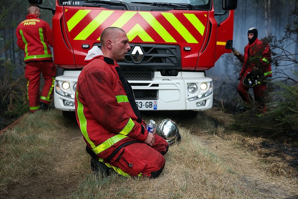 French firefighters near Bordeaux on Sunday. ALAIN JOCARD / AFP via Getty Images