You’re out of free articles.
Log in
To continue reading, log in to your account.
Create a Free Account
To unlock more free articles, please create a free account.
Sign In or Create an Account.
By continuing, you agree to the Terms of Service and acknowledge our Privacy Policy
Welcome to Heatmap
Thank you for registering with Heatmap. Climate change is one of the greatest challenges of our lives, a force reshaping our economy, our politics, and our culture. We hope to be your trusted, friendly, and insightful guide to that transformation. Please enjoy your free articles. You can check your profile here .
subscribe to get Unlimited access
Offer for a Heatmap News Unlimited Access subscription; please note that your subscription will renew automatically unless you cancel prior to renewal. Cancellation takes effect at the end of your current billing period. We will let you know in advance of any price changes. Taxes may apply. Offer terms are subject to change.
Subscribe to get unlimited Access
Hey, you are out of free articles but you are only a few clicks away from full access. Subscribe below and take advantage of our introductory offer.
subscribe to get Unlimited access
Offer for a Heatmap News Unlimited Access subscription; please note that your subscription will renew automatically unless you cancel prior to renewal. Cancellation takes effect at the end of your current billing period. We will let you know in advance of any price changes. Taxes may apply. Offer terms are subject to change.
Create Your Account
Please Enter Your Password
Forgot your password?
Please enter the email address you use for your account so we can send you a link to reset your password:
More Californians have searched for news about “floods” in 2023 than “wildfires,” which seems in keeping with this summer’s series of out-of-left-field climate disasters. The worst smoke pollution hit … the East Coast. The deadliest wildfire in modern U.S. history leveled … a former wetland in Hawaii. Naturally a hurriquake in Los Angeles and catastrophic flooding in Palm Springs would come next?
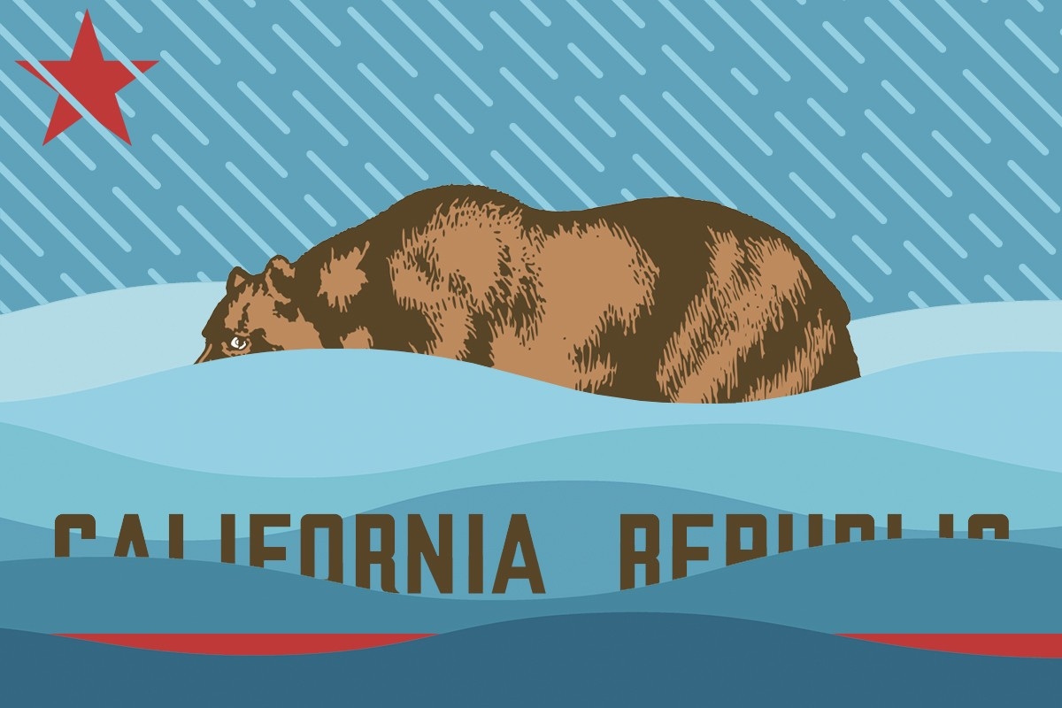
But California’s reputation as the land of drought and fire has obscured the fact that extreme flooding is the other player in the state’s deadly climatological triumvirate. From the atmospheric rivers this winter, which caused some 500 mudslides and inflicted as much as $1 billion in damage, to Hurricane Hilary dumping record-breaking rains over the southwestern United States this weekend, floods are understandably top-of-mind (especially with a relatedly somewhat slow start to the state’s fire season).
Here’s what you need to know about the future of extreme floods in the Golden State:
Former Hurricane Hilary was the first tropical storm to make landfall in California in 84 years, easily snapping the practically nonexistent late August daily rainfall records around L.A. In fact, hurricanes making landfall in the lower lefthand corner of the U.S. is so rare that there isn’t actually much of a data record for scientists to use as a point of comparison, Inside Climate News reports — which makes forming future projections and establishing links to climate change actually rather difficult.
What we do know is this: California has largely avoided hurricanes in the past due to the generally cold waters off its coast, which NBC News describes as acting as a sort of “shield” for the state. Hurricanes get their strength and moisture by forming over warm waters, and the eastern Pacific has historically been as much as 9 degrees cooler than the same latitude in the Gulf of Mexico.
But California’s shield has a crack. July was the hottest recorded month on planet Earth and the waters Hilary passed over on its journey north were 4 degrees warmer than usual, the Los Angeles Times explains. Sure enough, research shows that hurricane landfalls in the eastern Pacific could increase dramatically along with global and oceanic warming — bringing more rain and floods along with them.
There are certain conditions that made Hilary particularly unusual, however: A heat dome that formed over the central United States, for example, helped tug the storm directly over California, as opposed to a more typical path of a hurricane or tropical storm being pushed out to sea by easterly winds off the continent. So while hurricanes might be more intense and wet in the future, they won’t necessarily continue to make it over to California the way Hilary has.
Yes, to some extent. In addition to greenhouse gas emissions making the oceans warmer, the weather pattern called El Niño is likely responsible for some of the warming of the waters off of Baja California, which intensified Hurricane Hilary. But again, there were also unique conditions that contributed to Hilary’s unusual path over the southwestern United States, including the prevailing wind patterns. Strong El Niño years, as a result, don’t necessarily mean more hurricanes for Southern California.
El Niños have tended to bring higher winter rainfalls to Southern California, though that is also not necessarily a guarantee. NOAA’s outlook for the coming winter doesn’t currently show above-average precipitation expected for the state. Some El Niño years are actually drier than average, which goes to show that “El Niño is just one hand on the atmospheric steering wheel,” Weather Underground writes.
California isn’t a land of droughts or floods — it’s a land of both. A better way to think about the future of weather in the state is as one of extremes.
That’s because, “[i]n a seeming paradox, drought and flooding are two sides of one coin,” Governing explains. “A warmer atmosphere can hold more water, and higher temperatures cause more water on the Earth’s surface to evaporate. This can result in bigger rainstorms.”
The good news is, most of California is now free of drought conditions and this year’s fire season has been quieter because of all the wet vegetation. But while Tropical Storm Hilary apparently only inflicted minor damage and no known deaths this weekend, floods have been a devastating fixture of life in the Golden State before and they will be again.
As Yale Climate Solutions warned earlier this year, “Given the increased risk [due to climate change], it is more likely than not that many of you reading this will see a California megaflood costing tens of billions in your lifetime.”
California doesn’t need 40 days and nights of rain to experience its worst-case flood event, researchers have found. If a 30-day rainstorm similar to one that hit the then-unpopulous state in 1862 were to strike again today, it could potentially be a $1 trillion disaster — “larger than any in world history” — UCLA’s “ARkStorm 2.0” scenario modeling found last year.
“Every major population center in California would get hit at once — probably parts of Nevada and other adjacent states, too,” Daniel Swain, a UCLA climate scientist and co-author of the paper, said in a statement at the time.
Unlike a tropical storm, which passes in a number of days, the ARkStorm flood event would last a month in the form of sequential atmospheric rivers, like the kind that battered the state this past winter. The link between climate change and heavy precipitation is well understood, and the researchers found that “climate change has already doubled the likelihood of such an extreme storm scenario,” with “further large increases in ‘megastorm’ risk … likely with each additional degree of global warming this century.”
Log in
To continue reading, log in to your account.
Create a Free Account
To unlock more free articles, please create a free account.
The Senate told renewables developers they’d have a year to start construction and still claim a tax break. Then came an executive order.
Renewable energy advocates breathed a sigh of relief after a last-minute change to the One Big Beautiful Bill Act stipulated that wind and solar projects would be eligible for tax credits as long as they began construction within the next 12 months.
But the new law left an opening for the Trump administration to cut that window short, and now Trump is moving to do just that. The president signed an executive order on Monday directing the Treasury Department to issue new guidance for the clean electricity tax credits “restricting the use of broad safe harbors unless a substantial portion of a subject facility has been built.”
The broad safe harbors in question have to do with the way the government defines the “beginning of construction,” which, in the realm of federal tax credits, is a term of art. Under the current Treasury guidance, developers must either complete “physical work of a significant nature” on a given project or spend at least 5% of its total cost to prove they have started construction during a given year, and are therefore protected from any subsequent tax law changes.
As my colleague Matthew Zeitlin previously reported, oftentimes something as simple as placing an order for certain pieces of equipment, like transformers or solar trackers, will check the box. Still, companies can’t just buy a bunch of equipment to qualify for the tax credits and then sit on it indefinitely. Their projects must be up and operating within four years, or else they must demonstrate “continuous progress” each year to continue to qualify.
As such, under existing rules and Trump’s new law, wind and solar developers would have 12 months to claim eligibility for the investment or production tax credit, and then at least four years to build the project and connect it to the grid. While a year is a much shorter runway than the open-ended extension to the tax credits granted by the Inflation Reduction Act, it’s a much better deal than the House’s original version of the OBBBA, which would have required projects to start construction within two months and be operating by the end of 2028 to qualify.
Or so it seemed.
The tax credits became a key bargaining chip during the final negotiations on the bill. Senator Lisa Murkowski of Alaska fought to retain the 12-month runway for wind and solar, while members of the House Freedom Caucus sought to kill it. Ultimately, the latter group agreed to vote yes after winning assurances from the president that he would “deal” with the subsidies later.
Last week, as all of this was unfolding, I started to hear rumors that the Treasury guidance regarding “beginning of construction” could be a key tool at the president’s disposal to make good on his promise. Industry groups had urged Congress to codify the existing guidance in the bill, but it was ultimately left out.
When I reached out to David Burton, a partner at Norton Rose Fulbright who specializes in energy tax credits, on Thursday, he was already contemplating Trump’s options to exploit that omission.
Burton told me that Trump’s Treasury department could redefine “beginning of construction” in a number of ways, such as by removing the 5% spending safe harbor or requiring companies to get certain permits in order to demonstrate “significant” physical work. It could also shorten the four-year grace period to bring a project to completion.
But Burton was skeptical that the Treasury Department had the staff or expertise to do the work of rewriting the guidance, let alone that Trump would make this a priority. “Does Treasury really want to spend the next couple of months dealing with this?” he said. “Or would it rather deal with implementing bonus depreciation and other taxpayer-favorable rules in the One Big Beautiful Bill instead of being stuck on this tangent, which will be quite a heavy lift and take some time?”
Just days after signing the bill into law, Trump chose the tangent, directing the Treasury to produce new guidance within 45 days. “It’s going to need every one of those days to come out with thoughtful guidance that can actually be applied by taxpayers,” Burton told me when I called him back on Monday night.
The executive order cites “energy dominance, national security, economic growth, and the fiscal health of the Nation” as reasons to end subsidies for wind and solar. The climate advocacy group Evergreen Action said it would help none of these objectives. “Trump is once again abusing his power in a blatant end-run around Congress — and even his own party,” Lena Moffit, the group’s executive director said in a statement. “He’s directing the government to sabotage the very industries that are lowering utility bills, creating jobs, and securing our energy independence.”
Industry groups were still assessing the implications of the executive order, and the ones I reached out to declined to comment for this story. “Now we’re circling the wagons back up to dig into the details,” one industry representative told me, adding that it was “shocking” that Trump would “seemingly double cross Senate leadership and Thune in particular.”
As everyone waits to see what Treasury officials come up with, developers will be racing to “start construction” as defined by the current rules, Burton said. It would be “quite unusual” if the new guidance were retroactive, he added. Although given Trump’s history, he said, “I guess anything is possible.”
“I believe the tariff on copper — we’re going to make it 50%.”
President Trump announced Tuesday during a cabinet meeting that he plans to impose a hefty tax on U.S. copper imports.
“I believe the tariff on copper — we’re going to make it 50%,” he told reporters.
Copper traders and producers have anticipated tariffs on copper since Trump announced in February that his administration would investigate the national security implications of copper imports, calling the metal an “essential material for national security, economic strength, and industrial resilience.”
Trump has already imposed tariffs for similarly strategically and economically important metals such as steel and aluminum. The process for imposing these tariffs under section 232 of the Trade Expansion Act of 1962 involves a finding by the Secretary of Commerce that the product being tariffed is essential to national security, and thus that the United States should be able to supply it on its own.
Copper has been referred to as the “metal of electrification” because of its centrality to a broad array of electrical technologies, including transmission lines, batteries, and electric motors. Electric vehicles contain around 180 pounds of copper on average. “Copper, scrap copper, and copper’s derivative products play a vital role in defense applications, infrastructure, and emerging technologies, including clean energy, electric vehicles, and advanced electronics,” the White House said in February.
Copper prices had risen around 25% this year through Monday. Prices for copper futures jumped by as much as 17% after the tariff announcement and are currently trading at around $5.50 a pound.
The tariffs, when implemented, could provide renewed impetus to expand copper mining in the United States. But tariffs can happen in a matter of months. A copper mine takes years to open — and that’s if investors decide to put the money toward the project in the first place. Congress took a swipe at the electric vehicle market in the U.S. last week, extinguishing subsidies for both consumers and manufacturers as part of the One Big Beautiful Bill Act. That will undoubtedly shrink domestic demand for EV inputs like copper, which could make investors nervous about sinking years and dollars into new or expanded copper mines.
Even if the Trump administration succeeds in its efforts to accelerate permitting for and construction of new copper mines, the copper will need to be smelted and refined before it can be used, and China dominates the copper smelting and refining industry.
The U.S. produced just over 1.1 million tons of copper in 2023, with 850,000 tons being mined from ore and the balance recycled from scrap, according to United States Geological Survey data. It imported almost 900,000 tons.
With the prospect of tariffs driving up prices for domestically mined ore, the immediate beneficiaries are those who already have mines. Shares in Freeport-McMoRan, which operates seven copper mines in Arizona and New Mexico, were up over 4.5% in afternoon trading Tuesday.
Predicting the location and severity of thunderstorms is at the cutting edge of weather science. Now funding for that science is at risk.
Tropical Storm Barry was, by all measures, a boring storm. “Blink and you missed it,” as a piece in Yale Climate Connections put it after Barry formed, then dissipated over 24 hours in late June, having never sustained wind speeds higher than 45 miles per hour. The tropical storm’s main impact, it seemed at the time, was “heavy rains of three to six inches, which likely caused minor flooding” in Tampico, Mexico, where it made landfall.
But a few days later, U.S. meteorologists started to get concerned. The remnants of Barry had swirled northward, pooling wet Gulf air over southern and central Texas and elevating the atmospheric moisture to reach or exceed record levels for July. “Like a waterlogged sponge perched precariously overhead, all the atmosphere needed was a catalyst to wring out the extreme levels of water vapor,” meteorologist Mike Lowry wrote.
More than 100 people — many of them children — ultimately died as extreme rainfall caused the Guadalupe River to rise 34 feet in 90 minutes. But the tragedy was “not really a failure of meteorology,” UCLA and UC Agriculture and Natural Resources climate scientist Daniel Swain said during a public “Office Hours” review of the disaster on Monday. The National Weather Service in San Antonio and Austin first warned the public of the potential for heavy rain on Sunday, June 29 — five days before the floods crested. The agency followed that with a flood watch warning for the Kerrville area on Thursday, July 3, then issued an additional 21 warnings, culminating just after 1 a.m. on Friday, July 4, with a wireless emergency alert sent to the phones of residents, campers, and RVers along the Guadalupe River.
The NWS alerts were both timely and accurate, and even correctly predicted an expected rainfall rate of 2 to 3 inches per hour. If it were possible to consider the science alone, the official response might have been deemed a success.
Of all the storm systems, convective storms — like thunderstorms, hail, tornadoes, and extreme rainstorms — are some of the most difficult to forecast. “We don’t have very good observations of some of these fine-scale weather extremes,” Swain told me after office hours were over, in reference to severe meteorological events that are often relatively short-lived and occur in small geographic areas. “We only know a tornado occurred, for example, if people report it and the Weather Service meteorologists go out afterward and look to see if there’s a circular, radial damage pattern.” A hurricane, by contrast, spans hundreds of miles and is visible from space.
Global weather models, which predict conditions at a planetary scale, are relatively coarse in their spatial resolution and “did not do the best job with this event,” Swain said during his office hours. “They predicted some rain, locally heavy, but nothing anywhere near what transpired.” (And before you ask — artificial intelligence-powered weather models were among the worst at predicting the Texas floods.)
Over the past decade or so, however, due to the unique convective storm risks in the United States, the National Oceanic and Atmospheric Administration and other meteorological agencies have developed specialized high resolution convection-resolving models to better represent and forecast extreme thunderstorms and rainstorms.
NOAA’s cutting-edge specialized models “got this right,” Swain told me of the Texas storms. “Those were the models that alerted the local weather service and the NOAA Weather Prediction Center of the potential for an extreme rain event. That is why the flash flood watches were issued so early, and why there was so much advanced knowledge.”
Writing for The Eyewall, meteorologist Matt Lanza concurred with Swain’s assessment: “By Thursday morning, the [high resolution] model showed as much as 10 to 13 inches in parts of Texas,” he wrote. “By Thursday evening, that was as much as 20 inches. So the [high resolution] model upped the ante all day.”
Most models initialized at 00Z last night indicated the potential for localized excessive rainfall over portions of south-central Texas that led to the tragic and deadly flash flood early this morning. pic.twitter.com/t3DpCfc7dX
— Jeff Frame (@VORTEXJeff) July 4, 2025
To be any more accurate than they ultimately were on the Texas floods, meteorologists would have needed the ability to predict the precise location and volume of rainfall of an individual thunderstorm cell. Although models can provide a fairly accurate picture of the general area where a storm will form, the best current science still can’t achieve that level of precision more than a few hours in advance of a given event.
Climate change itself is another factor making storm behavior even less predictable. “If it weren’t so hot outside, if it wasn’t so humid, if the atmosphere wasn’t holding all that water, then [the system] would have rained and marched along as the storm drifted,” Claudia Benitez-Nelson, an expert on flooding at the University of South Carolina, told me. Instead, slow and low prevailing winds caused the system to stall, pinning it over the same worst-case-scenario location at the confluence of the Hill Country rivers for hours and challenging the limits of science and forecasting.
Though it’s tempting to blame the Trump administration cuts to the staff and budget of the NWS for the tragedy, the local NWS actually had more forecasters on hand than usual in its local field office ahead of the storm, in anticipation of potential disaster. Any budget cuts to the NWS, while potentially disastrous, would not go into effect until fiscal year 2026.
The proposed 2026 budget for NOAA, however, would zero out the upkeep of the models, as well as shutter the National Severe Storms Laboratory in Norman, Oklahoma, which studies thunderstorms and rainstorms, such as the one in Texas. And due to the proprietary, U.S.-specific nature of the high-resolution models, there is no one coming to our rescue if they’re eliminated or degraded by the cuts.
The impending cuts are alarming to the scientists charged with maintaining and adjusting the models to ensure maximum accuracy, too. Computationally, it’s no small task to keep them running 24 hours a day, every day of the year. A weather model doesn’t simply run on its own indefinitely, but rather requires large data transfers as well as intakes of new conditions from its network of observation stations to remain reliable. Although the NOAA high-resolution models have been in use for about a decade, yearly updates keep the programs on the cutting edge of weather science; without constant tweaks, the models’ accuracy slowly degrades as the atmosphere changes and information and technologies become outdated.
It’s difficult to imagine that the Texas floods could have been more catastrophic, and yet the NOAA models and NWS warnings and alerts undoubtedly saved lives. Still, local Texas authorities have attempted to pass the blame, claiming they weren’t adequately informed of the dangers by forecasters. The picture will become clearer as reporting continues to probe why the flood-prone region did not have warning sirens, why camp counselors did not have their phones to receive overnight NWS alarms, why there were not more flood gauges on the rivers, and what, if anything, local officials could have done to save more people. Still, given what is scientifically possible at this stage of modeling, “This was not a forecast failure relative to scientific or weather prediction best practices. That much is clear,” Swain said.
As the climate warms and extreme rainfall events increase as a result, however, it will become ever more crucial to have access to cutting-edge weather models. “What I want to bring attention to is that this is not a one-off,” Benitez-Nelson, the flood expert at the University of South Carolina, told me. “There’s this temptation to say, ‘Oh, it’s a 100-year storm, it’s a 1,000-year storm.’”
“No,” she went on. “This is a growing pattern.”